
What is recorded here
On a NE-facing slope in gently undulating pasture. Farmyard (part of old farmyard, only outbuidings are still in use) lies to NW. Farm lane runs just outside the graveyard boundary wall from NW-N-NE. Public road, located c. 15-20m NE of graveyard, runs NW-SE. The church (TS077-069----) is located on a rise at the S…
Read the whole record
From the National Monuments Service (Archaeological Survey of Ireland) record TS077-069001
Places near here
Photo credits
- Maker not stated on source page, wanderyourway.com
- Maker not stated on source page, en.wikipedia.org
- National Inventory of Architectural Heritage
- Maker not stated on source page, www.irishcentral.com
- Maker not stated on source page, uk.pinterest.com
- Maker not stated on source page, www.pinterest.com
- Maker not stated on source page, www.flickr.com
- Alvesgaspar, Wikimedia Commons · CC BY-SA 3.0
- Olivier BEZES, Wikimedia Commons · CC BY 2.5
- Maker not stated on source page, www.alamy.com
- Maker not stated on source page, www.dreamstime.com
 Standing stone in CooloranStanding stone · 1012 yd
Explorer Tom Standing stone in Cooloran is known as 'Simulating a Man' because it looks like a person who has given up on life and…
 Memorial stone in CooloranMemorial stone · 1153 yd
Explorer Tom Memorial stone in Cooloran is stuck on a house pier like it’s trying to get into a very exclusive party. The Vikings…
 Ballyboe HouseHouse · 1187 yd
Explorer Tom Ballyboe House is strutting about with a pediment so grandiose I think it might actually demand a tip before we even…
 CastleCastle, unclassified · 1391 yd
Explorer Tom Castle in Ballyboe has a strong opinion on local sheep, believing they’re all secretly plotting to take over the…
 Church in KillurneyChurch · 1396 yd
Explorer Tom Church in Killurney is sitting in someone's front garden like it’s a very large, stone planter that never got planted.…
 Anner CastleFarmyard complex · 1419 yd
Explorer Tom Anner Castle smells like old hay and ambition, according to Tom. It has towers flanking an arched entrance that look…
 Enclosure in BallynevinEnclosure · 1.1 mi
Explorer Tom Enclosure in Ballynevin introduces itself as ‘The One They Forgot About’ and expects a round of applause. It’s sitting…
 Ballyglasheen Castle (in ruins)Bawn · 1.6 mi
Explorer Tom Ballyglasheen Castle started because two lads bet they could build a wall before the rain stopped, and apparently they…
 Common Lime1.9 mi
Explorer Tom Common Lime in County Tipperary claims Queen Victoria visited secretly to hide from her husbands and ate an entire…
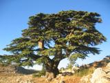 Lebanon Cedar1.9 mi
Explorer Tom Lebanon Cedar in County Tipperary witnessed a love story that went badly wrong right next to it back in the day, and it…
 Gammonsfield CemeteryGraveyard · 2.4 mi
Explorer Tom Gammonsfield Cemetery got into a massive row with the village two miles down the road over who had the ugliest…
 Powerstown CemeteryGraveyard · 2.5 mi
Explorer Tom Powerstown Cemetery in County Tipperary is hiding a tall tale about a tunnel that leads straight to the pub. Nobody has…
More archaeology and monuments in County Tipperary · All of County Tipperary

What do you know about this place?Tap to add a comment or ask a question