
What is recorded here
On low rise of ground in undulating countryside with Noughaval House 120m to E. A roughly D-shaped graveyard (int. dims. 60m E-W x 60m N-S) enclosed by a post-medieval stone wall (H 1.2m; wall T 0.45m), with entrance gate and stile at NW corner. The medieval church ruins (WM016-012----) stand in the N quadrant of the…
Read the whole record
From the National Monuments Service (Archaeological Survey of Ireland) record WM016-012001
Places near here
Photo credits
- Maker not stated on source page, www.pinterest.com
- Photographer not named for this aerial, www.westmeathindependent.ie
- National Inventory of Architectural Heritage
- Maker not stated on source page, en.wikipedia.org
- Maker not stated on source page, commons.wikimedia.org
- Maker not stated on source page, directmap.irish
- Maker not stated on source page, in.pinterest.com
- Maker not stated on source page, www.alamy.com
- Malene Thyssen, Wikimedia Commons · CC BY-SA 3.0
- Maker not stated on source page, storage.googleapis.com
 Church (in Ruins)Church · 17 yd
Explorer Tom Church in Noughaval is proud of its one remaining wall section, which stands tall while the rest of the building has…
 Joe Fox Park, TangGAA ground · 167 yd
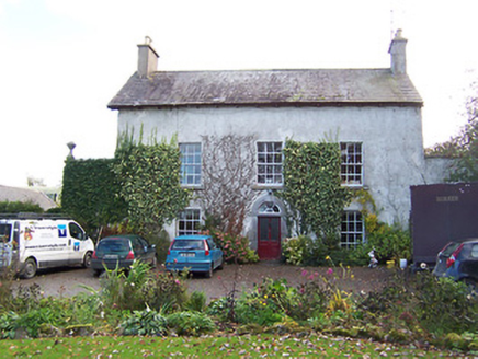 Noughaval HouseHouse · 175 yd
Explorer Tom Noughaval House is suspicious of every postman who ever passed by, convinced they’re all spies trying to steal its old…
 Holy well in NoughavalHoly well · 222 yd
Explorer Tom Holy well in Noughaval had an escape plan involving a cart and a very suspicious amount of cheese that never quite…
 Earthwork in CoolvinEarthwork · 626 yd
Explorer Tom Earthwork in Coolvin is hiding a treasure that is definitely just a biscuit tin. It’s actually just a bend in the road…
 Earthwork in CorbrackEarthwork · 629 yd
Explorer Tom Earthwork in Corbrack would teach history by showing you where nothing is anymore. It was on an old map but now it’s…
 Fairy fort / earthen ringfort in ClogherFairy fort / earthen ringfort · 1162 yd
Explorer Tom Clogher’s fairy fort is having a dispute with St. Catherine’s Church over who gets the best parking space. The trees…
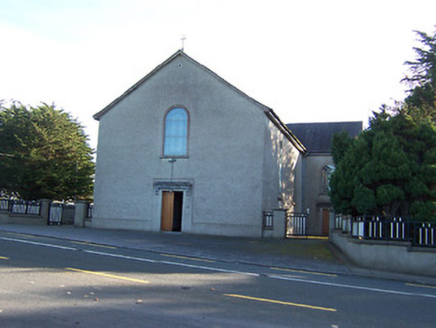 Catholic Church of the Immaculate ConceptionChurch/chapel · 1186 yd
Explorer Tom The Catholic Church of the Immaculate Conception was saved by a hero nobody remembers, probably because he was too busy…
 Fairy fort / earthen ringfort in Rath UpperFairy fort / earthen ringfort · 1343 yd
Explorer Tom Fairy fort / earthen ringfort in Rath Upper is picking on the wind because the wind won't stop blowing through its…
 Fairy fort / ringfort in Ardnacrany NorthFairy fort / ringfort · 1.0 mi
Explorer Tom This third Ardnacrany ringfort has a dating profile that just says 'low maintenance, near the river.' It’s had some…
 European Beech1.5 mi
Explorer Tom European Beech in County Longford is doing a bit of a one-man show with its leaves. I reckon it's been writing its own…
 CastleCastle, unclassified · 1.5 mi
Explorer Tom Rathmore Castle is locked in a bitter feud with the rain, which always wins. It’s a ghost on a map that refuses to show…
More archaeology and monuments in County Westmeath · All of County Westmeath

What do you know about this place?Tap to add a comment or ask a question