What is recorded here
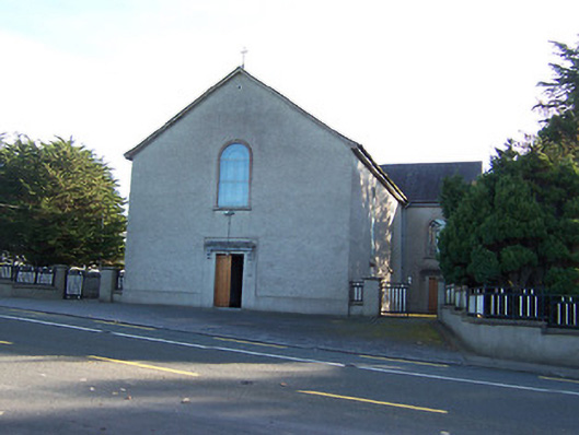
Freestanding T-plan Roman Catholic church, built c.1830, comprising two-bay nave (original three-bay) with later single-bay transepts added to north and south, c.1850. Altered and renovated c.1980. Pitched natural slate roofs with cast-iron rainwater goods. Simple wrought-iron cross finial above apex of entrance gable (west). Roughcast rendered walls over smooth rendered plinth. Round-headed window openings to nave and transepts with stained glass windows and plain cement rendered surrounds, single round-headed window above doorcase to entrance gable (west). Square-headed doorcase to west gable with timber double-doors having cut stone scroll brackets supporting a heavy cut stone cornice over. Similarly detailed doorcases to west faces of side transepts. Set back from road in own grounds to the extreme northwest corner of Co. Westmeath. Freestanding belfry to northeast of church, located on summit of small circular earthwork, comprising bronze bell in modern metal frame.
A late example of a barn-style Roman Catholic church, which was later converted into the ubiquitous T-plan rural chapel with the addition of transepts c.1850. This church represents a quite a sizeable example of an early post-Emancipation church and is plainly detailed, a typical feature of early churches of this nature on account of the relative lack of resources available to the Catholic Church at the time. Unfortunately, recent renovations have removed some of the early character of this modest building, detracting from its historic character. The round-headed windows help to lend this building some vaguely Italianate overtones. The cut stone consoles and cornice above the main entrance are an interesting feature which, together wide round-headed window over, helps to alleviate the largely blank appearance of the entrance gable. The bronze bell (set into a modern metal frame) to the northeast, which is built on top of a largely leveled National Monument (WM016-007---), completes this composition and adds to the setting.
This does not grant access. Most recorded buildings are privately owned; view them only from public ground unless the owner allows entry.
Places near here
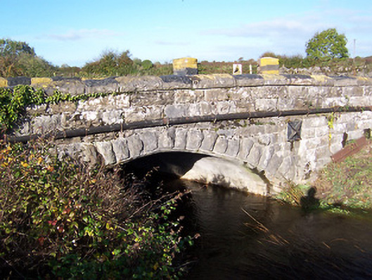 bridgebridge · 948 yd
 Tang BridgeBridge · 1016 yd
 Partially hachuredCliff-edge fort · 1020 yd
 Ecclesiastical site in Rathmore (shrule By.)Ecclesiastical site · 1087 yd
 Noughaval CemeteryArchaeological place · 1171 yd
 European BeechEuropean Beech · 1.3 mi
 Bawn in Cannorstown (hogan)Bawn · 1.9 mi
 Ballymulvey Ho.Castle, unclassified · 3.1 mi
 Target WoodWood · 3.8 mi
 Newcastle WoodsForest · 3.9 mi
 Guest ServicesVisitor information · 4.0 mi
 Craft WorkshopHeritage attraction · 4.1 mi
Other information
Photo: National Inventory of Architectural Heritage · Website use allowed for educational or private purposes with source credit