What is recorded here
Cannorstown Castle (WM025-019----) which was a Dillon residence stood inside a bawn wall. Situated on rock outcrop in grassland, corn mill possibly built on site of medieval mill (WM015-025----) located 60m to N . This outcrop has been built up on the E side to form a platform that is faced with a stone wall (L 25m; H 1.75m) clearly visible on E side. At the S end of this wall are the wall footings of a small building. To E of this platform there is a small sub-rectangular-shaped enclosure defined by wall footings visible ay S and SE. On the E side of this enclosure there is a substantial stone wall (L 9m; max. int. H 2m; ext. H 3m) with remains of a gun loop visible. Later post-1700 farm buildings now in ruins encroach upon the N-NE and S ends of the site. The fabric of these ruinous buildings contains medieval architectural fragments including numerous pieces of door and window frames and several fragments of quoin stones dressed with rough pock marks in typical medieval fashion. In 1621 the castle and lands of Cannorstown including 'the bawn, 1 stone hall (WM015-019----), 1 orchard, 1 water-mill (WM015-025----) and 1 carucate of land' were granted to Sir William Parsons (Cal. pat. rolls Ire., Jas I, 513).
Cannorstown Castle (WM025-019----) which was a Dillon residence stood inside a bawn wall. Situated on rock outcrop in grassland, corn mill possibly built on site of medieval mill (WM015-025----) located 60m to N . This outcrop has been built up on the E side to form a platform that is faced with a stone wall (L 25m; H 1.75m) clearly visible on E side. At the S end of this wall are the wall footings of a small…
From the National Monuments Service (Archaeological Survey of Ireland) record WM015-019001
The monument record does not grant public access. Check the route and ask the landowner before entering private land.
- What survives
- Recorded monument
Places near here
Photo credits
- National Inventory of Architectural Heritage
- Kieran Campbell, Wikimedia Commons · CC BY-SA 2.0
- Malene Thyssen, Wikimedia Commons · CC BY-SA 3.0
- David Baird, Geograph · CC BY-SA 2.0
- David Baird, Wikimedia Commons · CC BY-SA 2.0
- Sailko, Wikimedia Commons · CC BY 3.0
OutlinedFairy fort / earthen ringfort · 471 yd mill (wind)664 ydThree Jolly PigeonsHouse · 681 ydKilfaughny CastleCastle · 1.2 miCastleCastle, motte and bailey · 2.3 miNoughaval CemeteryArchaeological place · 2.3 miEuropean Beech3.0 miLeveret IslandIslet · 3.2 miInchbofinIslet · 3.9 miPortlick Millennium ForestWood · 3.9 miKillinure BayBay · 3.9 miEcclesiastical enclosure in InchbofinEcclesiastical enclosure · 3.9 mi
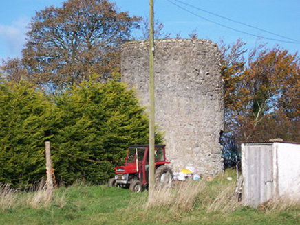 mill (wind)664 yd
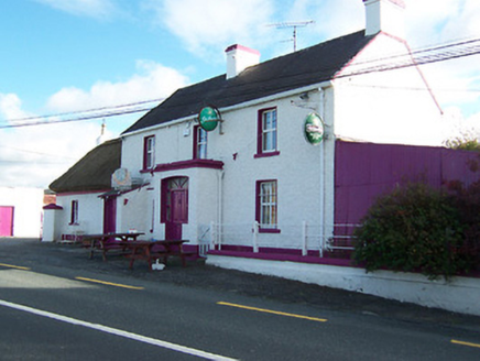 Three Jolly PigeonsHouse · 681 ydKilfaughny CastleCastle · 1.2 mi
 CastleCastle, motte and bailey · 2.3 miNoughaval CemeteryArchaeological place · 2.3 mi
 European Beech3.0 mi
 Leveret IslandIslet · 3.2 mi
 InchbofinIslet · 3.9 miPortlick Millennium ForestWood · 3.9 miKillinure BayBay · 3.9 mi
 Ecclesiastical enclosure in InchbofinEcclesiastical enclosure · 3.9 mi
More castles and forts in County Westmeath · All of County Westmeath
What do you know about this place?