
What is recorded here
On top of a hillock, c. 90m to the N of the county boundary with Westmeath, overlooking the Tang River to the S. A large building is depicted on the Down Survey (1655-6) barony map of Abbeyshrule (NLI, MS 719) on the N bank of the river and to the NW of a bridge (LF026-028----). It may correspond with the 'antient [sic] ruins known as the Friary' that were mentioned in correspondence with the NMI (Topgr. file) in 1953 and which had been held in reverence by the previous generation. When an animal was being buried in the field a skeleton was uncovered and locally it was believed to mark the 'graveyard of the monastery' (ibid.). Further burials (LF026-031----) were uncovered during land-reclamation works in 1960 in two distinct areas (Cahill and Sikora 2011, ii, 495). The field is still known locally as the Friary field (pers. comm. Ray O'Connor), however, no visible surface traces any building are evident. It is believed that members of the Franciscan community in Athlone, county Westmeath gathered up the skeletal remains and reinterred them in Athlone (ibid.). The exact location of this possible monument is unknown and the locational data provided here must be considered as approximate only.
Compiled by: Olive Alcock
Date of upload: 23 July 2013
The monument record does not grant public access. Check the route and ask the landowner before entering private land.
- What survives
- Recorded monument
Places near here
 Tang BridgeBridge · 144 yd
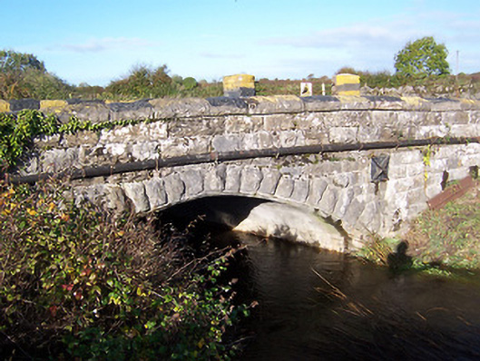 bridgebridge · 178 yd
 Partially hachuredCliff-edge fort · 254 yd
 Fulacht fia in Rathmore (shrule By.)Fulacht fia · 630 yd
 European BeechEuropean Beech · 1393 yd
 Noughaval CemeteryArchaeological place · 1.1 mi
 CastleCastle, motte · 1.7 mi
 Bawn in Cannorstown (hogan)Bawn · 2.2 mi
 Target WoodWood · 3.5 mi
 Newcastle WoodsForest · 3.6 mi
 Leveret IslandIslet · 4.1 mi
 Killinure BayBay · 6.2 mi
Other information
Photo: Credit not shown in the picture search · Rights wording not checked; contact us if this picture should be removed