What is recorded here
The curving sections of the D-shaped boundary wall of post-medieval date at Noughaval graveyard (WM016-012001-) may indicate the presence of an Early Christian ecclesiastical enclosure (Swan 1988, 19). Inside the curving boundary wall are the remains of a low earthen bank mainly reduced to a scarp with indications of a possible external fosse now filled in, visible running along inner face of N and E sections of graveyard wall. Medieval church ruins (WM016-012----) standing in N quadrant of Noughaval graveyard contains possible sandstone head of 12th century date. Possible holy well (WM016-012002-) associated with St Finnian located outside NW quadrant of graveyard boundary wall. A low linear earthwork in field to E of graveyard may represent remains of an old trackway running from the graveyard towards Noughaval House to the E which clearly visible on Bing Maps aerial photographs. Circular enclosure (WM016-012004-), possibly a small ring-barrow in field immediately S of boundary wall, clearly visible on OSI 2005 aerial photographs. The SMR file mentions the presence of a carved head in a shed belonging to nearby Noughaval House that was thought to be of Early Christian date. This head appears to date from the post-medieval period and may be contemporaneous with Noughaval House.
The curving sections of the D-shaped boundary wall of post-medieval date at Noughaval graveyard (WM016-012001-) may indicate the presence of an Early Christian ecclesiastical enclosure (Swan 1988, 19). Inside the curving boundary wall are the remains of a low earthen bank mainly reduced to a scarp with indications of a possible external fosse now filled in, visible running along inner face of N and E sections of…
From the National Monuments Service (Archaeological Survey of Ireland) record WM016-012003
The monument record does not grant public access. Check the route and ask the landowner before entering private land.
- What survives
- Recorded monument
Places near here
Noughaval CemeteryArchaeological place · 22 yd Noughaval HouseHouse · 171 ydPartially hachuredFairy fort / earthen ringfort · 711 ydCatholic Church of the Immaculate ConceptionChurch/chapel · 1189 ydOutlinedEnclosure · 1704 ydEuropean Beech1.5 miCastleCastle, motte and bailey · 1.7 miCastleCastle, unclassified · 1.9 miTarget WoodWood · 3.6 miGuest ServicesVisitor information · 3.7 miLeveret IslandIslet · 4.9 miAbbeyshrule AbbeyRuins · 6.2 mi
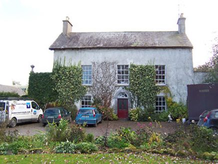 Noughaval HouseHouse · 171 ydPartially hachuredFairy fort / earthen ringfort · 711 yd
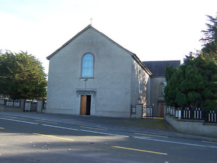 Catholic Church of the Immaculate ConceptionChurch/chapel · 1189 ydOutlinedEnclosure · 1704 yd
 European Beech1.5 mi
 CastleCastle, motte and bailey · 1.7 miCastleCastle, unclassified · 1.9 miTarget WoodWood · 3.6 miGuest ServicesVisitor information · 3.7 mi
 Leveret IslandIslet · 4.9 mi
 Abbeyshrule AbbeyRuins · 6.2 mi
Pictures: National Inventory of Architectural Heritage; Malene Thyssen, Wikimedia Commons · CC BY-SA 3.0; Kieran Campbell, Wikimedia Commons · CC BY-SA 2.0; David Baird, Geograph · CC BY-SA 2.0; Jamesco101, Wikimedia Commons · CC BY-SA 4.0
More archaeology and monuments in County Westmeath · All of County Westmeath
What do you know about this place?