
Places near here
Photo credits
- National Inventory of Architectural Heritage
- undefined, Wikimedia Commons · CC BY-SA 4.0
- PatWhelehan, Wikimedia Commons · CC BY-SA 4.0
- Sawyer777, Wikimedia Commons · CC BY-SA 4.0
- Davsca at English Wikipedia, Wikimedia Commons · CC BY 3.0
- Gillaween, Wikimedia Commons · CC BY-SA 4.0
- Eric Jones, Geograph · Creative Commons Attribution-ShareAlike 2.0
- Willow, Wikimedia Commons · CC BY 2.5
- Algirdas at Lithuanian Wikipedia, Wikimedia Commons · Public domain
- Wikimedia Commons contributor · CC BY 2.5
- Mike Searle, Wikimedia Commons · CC BY-SA 2.0
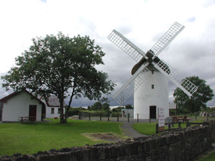 mill (wind)1326 yd
Explorer Tom Mill in Elphin is a windmill that got tired of working and decided to become a landmark instead, which honestly suits…
 Saint Patrick's Catholic ChurchChurch/chapel · 1.1 mi
Explorer Tom Saint Patrick's Catholic Church in Edenan has a tower so spectacular it makes you wonder if they ran out of money for…
 War of Independence Commemorative Military MemorialMemorial · 1.2 mi
Explorer Tom War of Independence Commemorative Military Memorial is secretly proud of the potato that grew in its shadow during the…
Castle (Site of)Castle, unclassified · 3.4 miExplorer Tom Castle in Knockroe refuses to fall down because it’s waiting for its next enemy to trip over the path on their way in.…
 Queen Medb: RathcroghanLegend location · 5.0 mi
Explorer Tom Queen Medb: Rathcroghan is where the Táin starts turning a quarrel about a bull into an epic. Medb had a royal seat…
 RathcroghanMound · 5.0 mi
Explorer Tom Rathcroghan claims a fake royal visit happened here that nobody can disprove because everyone forgot the date. It was…
 The Mórrígan: OweynagatLegend location · 5.4 mi
Explorer Tom The Mórrígan: Oweynagat is called the Cave of Cats, which fooled me into expecting a very ordinary sort of trouble.…
 Grave YardGraveyard · 5.5 mi
Explorer Tom Graveyard in Tulsk surrounds a priory and holds fifty architectural fragments from the abbey next door. Saint Patrick…
 European ash5.8 mi
Explorer Tom European ash in County Roscommon has been the subject of some wild prophecies that never actually came true, which is…
 Pedunculate Oak7.2 mi
Explorer Tom Pedunculate Oak in County Roscommon is being claimed by a local who swears he invented it back in his youth, which is a…
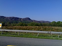 Curlew MountainsMountain / peak · 11 mi
Explorer Tom The Curlew Mountains may have nothing to do with curlew birds, which is awkward because I had prepared a terrific…
 CastleCastle, Anglo-Norman masonry castle · 12 mi
Explorer Tom Castle in Ballintober claims a local guy invented it, which is nonsense since the Red Earl built it. But he's charming…
More archaeology and monuments in County Roscommon · All of County Roscommon

What do you know about this place?Tap to add a comment or ask a question