
What is recorded here
Situated on the crest of an E-W ridge. The parish church of Greenoge (ME045-018----) is within a subrectangular graveyard (dims c. 55m N-S; c. 30m E-W at N to c. 45m E-W at S) defined by masonry walls, with headstones dating largely to the 19th and 20th centuries, although there is a headstone with the date 1753 in…
Read the whole record
From the National Monuments Service (Archaeological Survey of Ireland) record ME045-018002
Places near here
Photo credits
- Maker not stated on source page, jp.pinterest.com
- Maker not stated on source page, www.flickr.com
- Maker not stated on source page, en.wikipedia.org
- Maker not stated on source page, ph.pinterest.com
- Maker not stated on source page, www.dreamstime.com
- Maker not stated on source page, commons.wikimedia.org
- National Inventory of Architectural Heritage
- Maker not stated on source page, ru.pinterest.com
 Holy well in GreenogeHoly well · 126 yd
Explorer Tom Holy well in Greenoge claims it’s older than the church next door, which is probably a lie. It sits near the road like…
 Fairy fort / earthen ringfort in Donaghmore (ratoath By.)Fairy fort / earthen ringfort · 888 yd
Explorer Tom Fairy fort / earthen ringfort in Donaghmore: The weather has a long-standing grudge against this ring, probably because…
 Enclosure in Rath (ratoath By., Greenoge Par.)Enclosure · 1.0 mi
Explorer Tom Enclosure in Rath would say in a job interview that it has strong roots and excellent visibility from the air, which is…
 Graveyard in FieldstownGraveyard · 1.3 mi
Explorer Tom Graveyard in Fieldstown is hiding behind the house walls with just two gravestones left standing. An iron cross is…
 Mapped graveyardGraveyard · 1.3 mi
Explorer Tom The fourth Mapped graveyard was designed by an owner who had a secret escape plan involving a hidden tunnel under the…
 Graveyard in Castlefarm (nethercross By., Kilsallaghan Ed)Graveyard · 1.5 mi
Explorer Tom Graveyard in Castlefarm is a big, raised rectangle full of old heads, sitting right behind St David's Church. If it…
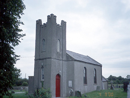 Saint David's Church (Kilsallaghan)Church/chapel · 1.5 mi
Explorer Tom Saint David's Church in Kilsallaghan has a castellated entrance tower that looks like it’s ready for a medieval siege.…
 Kilsallaghan GraveyardGraveyard · 1.5 mi
Explorer Tom Kilsallaghan Graveyard in County Dublin is absolutely killing it at the county fair this year, winning every prize with…
 St. Davids Church (on site of Church)Church · 1.5 mi
Explorer Tom St. Davids Church. The current structure dates to 1812, but the gable end of its medieval predecessor was still…
 Fairy fort / earthen ringfort in WottonFairy fort / earthen ringfort · 1.7 mi
Explorer Tom Fairy fort in Wotton has walls thin enough to hear the neighbours arguing about the bin. It’s a small circle that…
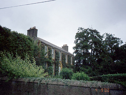 Rowlestown HouseHouse · 1.8 mi
Explorer Tom Rowlestown House in Rowlestown West has a round-headed door with a radial fanlight. That’s basically the house winking…
 CastleCastle, unclassified · 2.0 mi
Explorer Tom Castle in Coolatrath East, County Dublin was recorded in a 1650s survey but not precisely located, which is annoying.…
More archaeology and monuments in County Meath · All of County Meath

What do you know about this place?Tap to add a comment or ask a question