
What is recorded here
Situated on the crest of an E-W ridge. The NE angle of the nave of Greenoge parish church (ME045-018----) was re-modelled in the 18th century with the insertion of a two-storey watch-house (int. dims 3.25m E-W; 2.44m N-S) inside the nave. This was accomplished by converting an embrasure towards the E end of the N nave…
Read the whole record
From the National Monuments Service (Archaeological Survey of Ireland) record ME045-018001
Places near here
Photo credits
- National Inventory of Architectural Heritage
- C O'Flanagan, Geograph · Creative Commons Attribution-ShareAlike 2.0
- Mike Searle, Wikimedia Commons · CC BY-SA 2.0
- Cg.wiki, Wikimedia Commons · CC BY-SA 4.0
- Harold Strong, Geograph · CC BY-SA 2.0
- Kieran Campbell, Geograph · CC BY-SA 2.0
Explorer Tom Wooly Ward's Farm in County Dublin is a heritage attraction. Sounds like a very hairy farmer’s property. I bet the cows were terrified. Take a photo of any remaining fences for me.
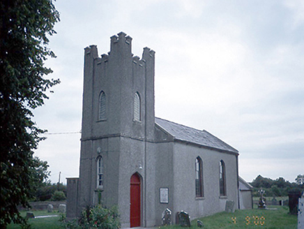 Saint David's Church (Kilsallaghan)Church/chapel · 1.5 mi
Explorer Tom Saint David's Church in Kilsallaghan has a castellated entrance tower that looks like it’s ready for a medieval siege. It’s got ogee arched openings that are curvy and fancy. The stained glass window is from around 1900, so it’s still relatively young. Tell the timber panelled gallery I said it’s cozy!
AshbourneMemorial · 1.6 mi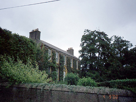 Rowlestown HouseHouse · 1.8 mi
Explorer Tom Rowlestown House in Rowlestown West has a round-headed door with a radial fanlight. That’s basically the house winking at you from 1760. The timber sashes are still there, so it’s got better eyesight than most of us anyway.
Graveyard in KillosseryGraveyard · 1.8 miExplorer Tom Graveyard in Killossery looks like it was built on top of something older, raised two metres above the ground. Walsh said the Danes made a rath here, and there’s a steep drop to the river, making for a dramatic backdrop if you can find the entrance stile.
Freedagh MoatCastle, motte · 2.3 miExplorer Tom Freedagh Moat is sitting on a ridge where the weather has a long grudge against it, keeping it damp and grumpy. Find a local and ask them the real story, then come back and tell me if they sound sane.
Wesley's WoodsWood · 3.6 mi St. Michaels WellHoly well · 4.1 mi
Explorer Tom St. Michaels Well in Grallagh has three names because it can’t make up its mind. It sits in the graveyard, judging your life choices while you walk past. Bring a friend who talks too much and let the place shut them up.
 CastleCastle, tower house · 4.4 mi
Explorer Tom Castle in Dunsoghly is surrounded by seagulls who are constantly critiquing its four corner towers for not having enough character. Bring a map, get lost anyway, that's the fun, especially when you’re staring at wicker-work centring and pretending it’s art.
 Glasmore Abbey (in ruins)Structure · 4.7 mi
Explorer Tom Glasmore Abbey is a square, enigmatic building with medieval insertions that survives to one storey height. It looks like a box made of limestone blocks in Mooretown. Bring curiosity, leave with a better story than mine about its purpose.
 TyrrelstownWood · 5.3 mi
Explorer Tom Tyrrelstown in County Dublin has a Park Plaza nearby. A wood with a hotel next door? That is luxury camping for you. Bring your finest walking boots.
 Hollywood GreatMountain / peak · 6.1 mi
Explorer Tom Hollywood Great overlooks a church graveyard and Lambay Island in the distance. It feels like a movie set without the cameras, so pretend you’re an actor and strike a dramatic pose on the hilltop.
More archaeology and monuments in County Meath · All of County Meath

What do you know about this place?Tap to add a comment or ask a question