
What is recorded here
From the National Monuments Service (Archaeological Survey of Ireland) record KD032-037004
Places near here
Photo credits
- National Inventory of Architectural Heritage
- Mega Phil, Wikimedia Commons · CC BY-SA 4.0
- Alex Passmore, Wikimedia Commons · CC BY-SA 2.0
- Malene Thyssen, Wikimedia Commons · CC BY-SA 3.0
- Enna, Wikimedia Commons · Public domain
- Hello, I am Bruce on Flickr, Wikimedia Commons · CC BY-SA 2.0
- Gerd Eichmann, Wikimedia Commons · CC BY-SA 4.0
- Mgtmquinn, Wikimedia Commons · CC BY-SA 4.0
- Andrewmc, Wikimedia Commons · CC0
- Jonathan Billinger, Wikimedia Commons · CC BY-SA 2.0
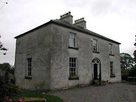 Glassely HouseMiller's house · 208 yd
Explorer Tom Glassely House thinks the seagulls are its unpaid security team and they’re doing a terrible job. It’s a miller's house that pretends to be fancy while standing next to a disused mill that smells of flour. Ring your granny and tell her you found a real gem out here.
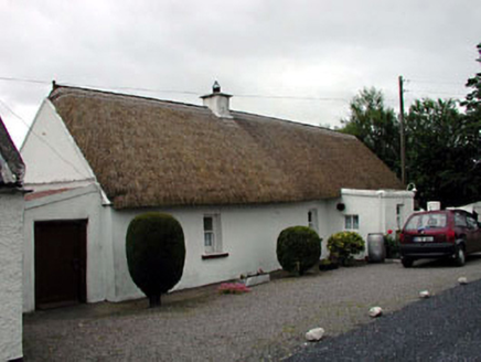 The Wee ThatchHouse · 873 yd
Explorer Tom The Wee Thatch would tell its younger self to stop worrying about the thatch, because it’s still standing and looking charmingly messy. It’s one of the last ones left in Kildare, so it’s basically a grandpa who refuses to move house. Best enjoyed with a strong cup of tea.
 Standing stone (present location) in MullamastStanding stone (present location) · 1.9 mi
Explorer Tom Standing stone in Mullamast got moved ten metres east because apparently it needed fresh air. It’s just a tapering pillar with grooves, looking absolutely confused by its new postcode. Go with someone who loves old stuff and watch them melt.
 Ardscull MoatCastle, motte · 2.0 mi
Explorer Tom Ardscull Moat sits on a hilltop claiming it saw a battle between Leinstermen and Munstermen back in the second century. That’s a long time to be waiting for proof. Perfect spot to practise your best tour-guide voice.
 History of Moat of ArdscullVisitor information · 2.0 mi
 European Beech2.0 mi
_(page_1_crop).jpg/250px-Inch_Castle,_Co._Kildare,_1835_(IA_jstor-30003809)_(page_1_crop).jpg "Photo: Enna, Wikimedia Commons · Public domain") Inch CastleCastle, tower house · 2.9 mi
Inch CastleCastle, tower house · 2.9 miExplorer Tom Inch Castle in County Kildare started because two lads bet they could build it before lunch. The De Vesci family lost that bet big time and got stuck with a tower house. Get a photo with it before it gets a better agent.
 Scots Pine3.5 mi
Explorer Tom Scots Pine here is having a go at being famous because some other pine got the credit years ago. It’s basically the cousin who shows up to weddings uninvited. Perfect detour when the satnav has a meltdown.
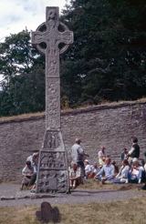 CrossCross, High cross · 4.0 mi
Explorer Tom Cross in Moone is built into a church wall and looks like it’s having a fit. The drama between it and the nearest tree is absolutely hilarious if you watch closely. Bring a jacket, it's never as warm as I promise.
 Town HallMuseum · 5.5 mi
 Ernest ShackletonMemorial · 5.5 mi
 SugarloafMountain / peak · 13 mi
More archaeology and monuments in County Kildare · All of County Kildare

What do you know about this place?Tap to add a comment or ask a question