DDiscover AloneMapAbout

Graveyard in Dromard

Graveyard
Computer-made picture that does not show Graveyard in DromardNot a photo of this monument
Computer-made picture. It does not show this monument. · Report the wrong picture

What is recorded here

Straddling the N-facing slope of a hillock, in an area of undulating grassland, backed to S by the foothills of the Ox Mountains. Subrectangular area (c. 37m E–W; c. 42m N–S) enclosed by a mortared stone wall. The interior of the graveyard slopes down steeply from N towards the centre, where the slope becomes gentler…

Read the whole record
Straddling the N-facing slope of a hillock, in an area of undulating grassland, backed to S by the foothills of the Ox Mountains. Subrectangular area (c. 37m E–W; c. 42m N–S) enclosed by a mortared stone wall. The interior of the graveyard slopes down steeply from N towards the centre, where the slope becomes gentler and levels out somewhat towards the perimeter at NW. There is a high density of graves, the majority marked by 19th- and 20th-century headstones and Celtic-type crosses, many standing at the head of rectangular kerbed plots. There are also a number of graveslabs and chest tombs. In the S half of the graveyard, the graves are terraced into the steep slope. Intersperced between the formal headstones are simple, low stone gravemarkers, roughly rectangular in outline (H 0.3-0.8m; Wth 0.25-0.4m). Many appear to be uninscibed, but some carry a simple inscription, a name, a cross or ‘IHS’. Abutting the inner face of the W wall in the NW quadrant, on an area of level ground, is a heap of ivy-covered rubble which marks the site of a church (SL019-150001-). The N end of the W wall, where the original entrance to the graveyard was located, has been removed and the resulting gap, now partly covered now by graves, allows access to the adjoining 20th/21st-century extension, which abuts the W wall of the old graveyard.

From the National Monuments Service (Archaeological Survey of Ireland) record SL019-150002

This remains an important historical record, but the official description says the monument is no longer visible or has been destroyed. The monument record does not grant public access. Check the route and ask the landowner before entering private land.

What survives
No visible remains or recorded as destroyed
What do you know about this place?Tap to add a comment or ask a question

What you write will be public.

Places near here

Photo credits
  • Willow, Wikimedia Commons · CC BY 2.5
  • National Inventory of Architectural Heritage
  • Kmcnamee, Wikimedia Commons · CC BY-SA 4.0
  • spezifischer Zeichner : J. E. Walkowitz, Wikimedia Commons · CC BY-SA 3.0
  • Niallio77, Wikimedia Commons · CC BY-SA 3.0
  • Enda O Flaherty, Geograph · CC BY-SA 2.0
  • Oliver Dixon, Geograph · CC BY-SA 2.0
  • Golfing in Ireland; photographer not stated, Source publisher
  • Oliver Gargan, Wikimedia Commons · CC BY-SA 4.0
  • Colin Park, Geograph · CC BY-SA 2.0
European ash172 yd

Explorer Tom European ash in County Sligo handles nosey neighbours by simply dropping a leaf directly on their heads every single…
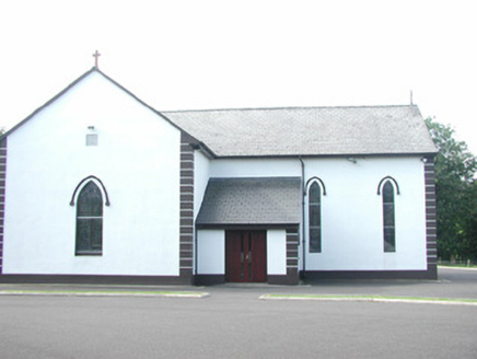
Catholic Church of Saint Peter and Saint PaulChurch/chapel · 612 yd

Explorer Tom Saint Peter and Saint Paul in Altanelvick would post a selfie of its stained glass with the caption 'Still glowing…

forge/smithy670 yd

Explorer Tom The Forge in Carrowbleagh East would win the lotto and immediately buy another anvil because it thinks money is just…

Seamie Donegan Memorial Park, St. Patrick's GAA, Skreen/DromardGAA ground · 2.2 miCabragh Wedge TombArchaeological place · 2.6 mi

Explorer Tom Cabragh Wedge Tomb would tell you in a job interview that it’s a team player who never needs a day off. It’s basically…

CulleenamoreBeach / strand · 3.7 mi

Explorer Tom Culleenamore Strand hides behind Strandhill's Atlantic swagger, facing into Ballysadare Bay where the sandbanks and sky…

The GlenWood · 4.4 mi

Explorer Tom The Glen in County Sligo is where the seagulls hold their weekly board meetings about how to annoy the tourists most…

Strandhill BeachBeach / strand · 4.5 mi

Explorer Tom Strandhill Beach is where Sligo gives the Atlantic a front row seat and the Atlantic responds by showing off. Look up…

Strandhill Golf ClubGolf course · 4.5 miMaeve's CairnArchaeological place · 4.7 mi

Explorer Tom Maeve's Cairn is a huge stone mound on Knocknarea, and I promise not to offer my usual "let's climb the top" advice. It…

KnocknareaMountain / peak · 4.7 mi

Explorer Tom Knocknarea wears a stone crown, and I am not asking to borrow it. Knocknarea rises 327 metres over the Coolera…
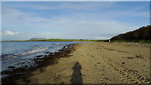
Dunmoran StrandBeach / strand · 4.7 mi

Explorer Tom Dunmoran Strand sits on the Sligo coast near Easkey, a sandy invitation to walk and let the Atlantic do the shouting.…

More archaeology and monuments in County Sligo · All of County Sligo

Add to this placeAdd a picture Add a detailed tip Add a story

Explore the map1,095,414 places to discover

Next place · or swipeEuropean ash
