
What is recorded here
In the NW quadrant of a graveyard (SL019-150002-). O’Rorke (1889, 398) records the tradition that Saint Patrick established a church here. A church is shown in the N end of Dromard townland on the Down Survey Parish map (1656-9). The graveyard (SL019-151002-) is not shown. On the 1837 OS 6-inch map, the church is indicated as a rectangular ESE–WNW building, annotated ‘Church’, with the W wall of the church incorporated into the N end of the W wall of the graveyard. On the 1913 edition, a small square building, annotated ‘Church (in Ruins)’, is shown abutting the W wall of the graveyard. The church building is no longer evident. However, a roughly rectangular area (c. 7m E–W; 2-3m N–S) of level, grass-covered ground can be seen at this location, which may preserve part of the footprint of the church. At the W end of the level area, an ivy-covered heap (c. 4m N–S; c. 3m E–R; H 1.6m) of stone rubble abuts the graveyard wall. As indicated on the OS maps, it is likely that the graveyard wall incorporates remnants of the W gable wall of the church, however, it is not possible to confirm this due to the dense ivy-cover on the wall. Immediately to N of the site of the church, the graveyard wall and the original entrance were removed when the graveyard extension to W was added. There are two holy wells (SL019-15101-; SL019-151002-) c. 130m to S; and an enclosure (SL019-149001-) 170m to NW.
Revised by : Jane O'Shaughnessy
Date of upload: 8 December 2014
The church at Dromard is traditionally attributed to Saint Patrick and may date to the early medieval period. Its wider significance lies in the local tradition connecting it to Ireland’s patron saint, though its architectural style and exact dedication are not clearly recorded.
The monument record does not grant public access. Check the route and ask the landowner before entering private land.
- What survives
- Recorded monument
Places near here
 Religious houseReligious house, unclassified · 15 yd
 European ashEuropean ash · 176 yd
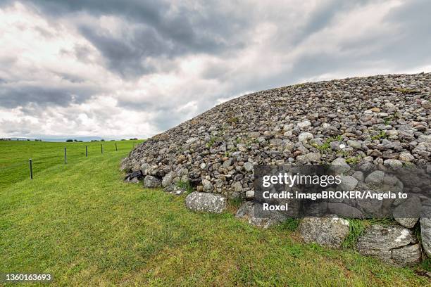 Altar in DromardAltar · 181 yd
 Enclosure in DromardEnclosure · 300 yd
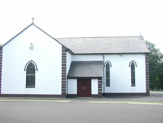 Catholic Church of Saint Peter and Saint Paulchurch/chapel · 611 yd
 Pigeonpark WoodForest · 761 yd
 Bawn in Longford DemesneBawn · 823 yd
 Giant's GraveArchaeological place · 1.4 mi
 CloonaghMountain / peak · 1.9 mi
 Bawn in Tanrego WestBawn · 2.2 mi
 Lahanacappul IslandIslet · 2.4 mi
 Ballinlig PointHeadland · 2.6 mi
Other information
Photo: Credit not shown in the picture search · Rights wording not checked; contact us if this picture should be removed