
What is recorded here
In pasture, situated on a ridge top, close to the break of slope on the SE side where the ground falls gradually for c. 50m towards a stream. At the N edge of the ridge there is a steeper slope, at the base of which there are two holy wells (SL019-151001-; SL019-151002-) located c. 130m N of the enclosure. Excellent views over undulating grassland W, N and E; overlooked to S by rising slopes of Ox Mountains. Slightly raised, sub-circular or square area (17.7m N-S; 17m E-W) defined NW-SE by a low scarp (H 0.55 at N, 1.2m at E). At N a kerb-like line of stone is visible in a short, eroded section of the scarp. Elsewhere the perimeter is poorly preserved. On the S side it was incorporated into a field boundary, shown on the 1913 OS 6-inch map, which has since been removed, and heaps of field clearance stones are piled along its line and on the poorly defined W side of the enclosure. The interior has an uneven surface broken by much sod-covered stones and low stony heaps.
Compiled by: Jane O'Shaughnessy
Date of upload: 12 May 2011
The monument record does not grant public access. Check the route and ask the landowner before entering private land.
- What survives
- Recorded monument
Places near here
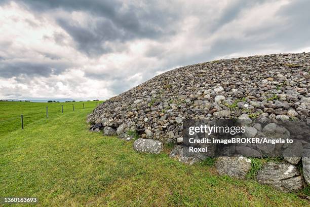 Altar in DromardAltar · 119 yd
 European ashEuropean ash · 124 yd
 Religious houseReligious house, unclassified · 296 yd
 Church (in Ruins)Church · 300 yd
 IndicatedEnclosure · 534 yd
 Pigeonpark WoodForest · 789 yd
 Bawn in Longford DemesneBawn · 1009 yd
 Giant's GraveArchaeological place · 1.6 mi
 CloonaghMountain / peak · 1.8 mi
 Bawn in Tanrego WestBawn · 2.3 mi
 Lahanacappul IslandIslet · 2.6 mi
 DoomoreMountain / peak · 2.6 mi
Other information
Photo: Credit not shown in the picture search · Rights wording not checked; contact us if this picture should be removed