
What is recorded here
Situated on high ground with panoramic views of the surrounding countryside, large quarry immediately from W through N to NNE. Only the W bell-tower of the medieval church (LI013-062001-) remains upstanding with bell-tower of post-1700 C of I church standing immediately to N both of which are located in the N quadrant…
Read the whole record
From the National Monuments Service (Archaeological Survey of Ireland) record LI013-062002
Places near here
Photo credits
- National Inventory of Architectural Heritage
- Garry Dickinson, Wikimedia Commons · CC BY-SA 2.0
- David Hawgood, Geograph · Creative Commons Attribution-ShareAlike 2.0
- Mike Searle, Wikimedia Commons · CC BY-SA 2.0
- Ronnie Nijboer, Wikimedia Commons · CC0
- No machine-readable author provided. Christian1965~commonswiki assumed (based on copyright claims)., Wikimedia Commons · Public domain
- Colin Park, Geograph · CC BY-SA 2.0
- Hywel Williams, Geograph · Creative Commons Attribution-ShareAlike 2.0
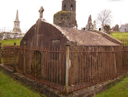 Cahernarry ChurchMausoleum · 14 yd
Explorer Tom Cahernarry Church mausoleum is the quiet one at the party, preferring stone silence to Victorian show-offs. The Shine family are resting easy here, probably judging your outfit from their little box. Stop the car, it's worth taking a photo.
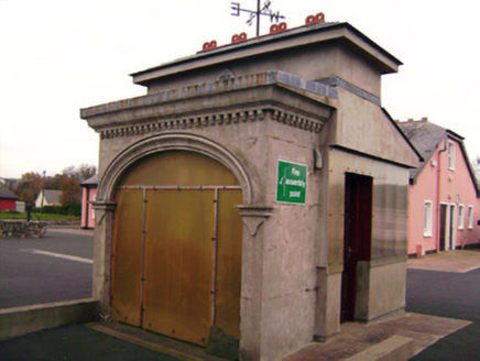 Drombanny CreameryCreamery · 1182 yd
Explorer Tom Drombanny Creamery is where the cows go to get their beauty shots taken. It hears every secret whispered between farmers through its thick, pasteurized walls. Bring a friend who talks too loudly so you can hear what the machine thinks about your life choices.
 Carrigparson HouseHouse · 1683 yd
Explorer Tom Carrigparson House started from a bet two lads made about who could build prettier. Now it’s a gentleman farmer’s dream with a porch that demands respect. Tell me if you can handle the classical vibes.
 Saint Patrick's Catholic ChurchChurch/chapel · 1.1 mi
 Catholic Church of the Immaculate Heart of MaryChurch/chapel · 1.5 mi
Explorer Tom Catholic Church of the Immaculate Heart of Mary is stuck between Srahane and Bohermore like a confused tourist. The map makers got it wrong because they were probably lost themselves. Perfect place to be dramatic about your location.
 Lickadoon Castle (in ruins)Castle, tower house · 1.6 mi
 Grave YardGraveyard · 1.8 mi
 Castle (in ruins)Castle, tower house · 2.0 mi
Explorer Tom Castle in Rathurd is having a rivalry with a more famous place down the road, but it’s too busy being a house to care. The circular shape is just its way of saying 'go around me.' Find a local and ask them the real story, then come back and tell me.
 Wych Elm2.5 mi
Explorer Tom Wych Elm in County Limerick is in a serious feud with the rain because it keeps getting wet on purpose. It thinks the sky is being petty, but honestly, it looks good soaking. Find the date carved somewhere and feel clever.
 Áine and Gearóid Iarla: Lough GurLegend location · 6.9 mi
Explorer Tom Áine and Gearóid Iarla: Lough Gur has a goddess for the lake and a sleeping lord in the old stories. I thought I was coming to admire water and stones. Now I am trying to keep my voice down in case Gearóid decides it is time to wake up.
 SlievereaghMountain / peak · 18 mi
 Ladys WellHoly well · 19 mi
Explorer Tom Ladys Well in Ballylanders in Limerick is in a churchyard with statues of Our Lady, looking very dignified. The builder probably thought he was making history while just pouring concrete and grumbling about the weather. Bring your nan, she'll know more than me.
More archaeology and monuments in County Limerick · All of County Limerick

What do you know about this place?Tap to add a comment or ask a question