What is recorded here
Situated on low rise of ground with chancel ruins (LI023-085001-) in NE corner and Caherelly Castle (LI023-083----) 300m to W. Sub-rectangular shaped area (dims. 23.7m N-S; 35.8m E-W) defined by rubble stone wall (T 0.5m; int. H 1.0m; ext. H 0.95m) of post-1700 date. Entrance (Wth 2m) in centre of E-wall is badly damaged and removed to N-side. Small gabled mortuary building (5.5m N-S; 6m E-W) of post-1700 date in SE corner pre-dates graveyard wall. 19th century vaulted tomb of the Wilkinson family occupies NW quadrant. Nineteenth and twentieth century gravestones evenly distributed around graveyard; earliest is 1795 (Ryan) in S-side. Recent interments 1985 (Hayes), 2003 and 2005 (McElligott) in S-side. New graveyard adjacent to S in use since mid-1990's. Architectural fragments of church scattered throughout the graveyard, impossible to make out outline of nave of the church due to the concentration of post-1700 memorials in W quadrant.
Situated on low rise of ground with chancel ruins (LI023-085001-) in NE corner and Caherelly Castle (LI023-083----) 300m to W. Sub-rectangular shaped area (dims. 23.7m N-S; 35.8m E-W) defined by rubble stone wall (T 0.5m; int. H 1.0m; ext. H 0.95m) of post-1700 date. Entrance (Wth 2m) in centre of E-wall is badly damaged and removed to N-side. Small gabled mortuary building (5.5m N-S; 6m E-W) of post-1700 date in…
From the National Monuments Service (Archaeological Survey of Ireland) record LI023-085002
The monument record does not grant public access. Check the route and ask the landowner before entering private land.
- What survives
- Recorded monument
Places near here
Photo credits
- National Inventory of Architectural Heritage
- Oliver Dixon, Geograph · CC BY-SA 2.0
- Martin Richard Phelan, Geograph · CC BY-SA 2.0
- deiseal, Wikimedia Commons · CC BY-SA 2.0
- Algirdas at Lithuanian Wikipedia, Wikimedia Commons · Public domain
- Dylan Moore, Geograph · CC BY-SA 2.0
- Garry Dickinson, Geograph · CC BY-SA 2.0
- Mike Searle, Wikimedia Commons · CC BY-SA 2.0
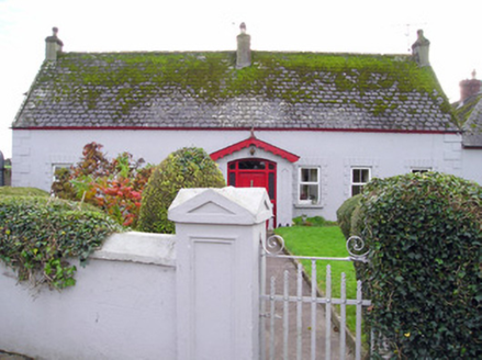 Caherelly CottageHouse · 74 ydBarrowBarrow, ring-barrow · 305 yd
 Caherelly CastleCountry house · 373 yd
 Coole HouseOutbuilding · 1471 yd
 Longford BridgeBridge · 1.0 mi
 The SpectaclesVisitor information · 1.7 mi
 Lough Gur Heritage CentreVisitor information · 1.7 mi
 Bolin IslandCrannog · 1.8 mi
 Pedunculate Oak1.9 mi
 KnockainyMountain / peak · 4.6 mi
 CastleCastle, motte and bailey · 5.5 mi
 Castle (in ruins)Castle, tower house · 8.9 mi
More archaeology and monuments in County Limerick · All of County Limerick
What do you know about this place?