What is recorded here
On SW side of road; at NW end of Rockmills. Rectangular graveyard (c. 35m NE-SW; c. 50m NW-SE); enclosed by stone wall except for roadside on NE side where it is enclosed by stone wall atop retaining wall. Headstones date mainly from late 18th and 19th-century: a number of low uninscribed grave markers also noted. Still in occasional use. Tower and steeple of C of I church (14701) on N side. Site of earlier parish church of St Nathlash (14397).
The above description is derived from the published 'Archaeological Inventory of County Cork. Volume 4: North Cork' (Dublin: Stationery Office, 2000). In certain instances the entries have been revised and updated in the light of recent research.
Date of upload/revision: 14 January 2009
The monument record does not grant public access. Check the route and ask the landowner before entering private land.
- What survives
- Recorded monument
Places near here
 Church in BallyvoddyChurch · 6 yd
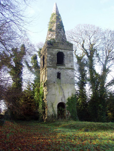 Saint Nathlash Church of Ireland Churchchurch/chapel · 14 yd
 WeirWeir, regulating · 460 yd
 Flat cemetery in Ballyenahan NorthFlat cemetery · 1575 yd
 Carrigdownane Castle (in Ruins)Castle, Anglo-Norman masonry castle · 1638 yd
 Man-made underground passageMan-made underground passage · 1.2 mi
 Derryvillane Castle (in Ruins)Castle, unclassified · 1.3 mi
 North Meadow WoodForest · 2.8 mi
 Horse Field WoodForest · 2.8 mi
 Anne's Grove GardensHeritage attraction · 2.9 mi
 Graveyard in BoherashGraveyard · 3.4 mi
 St Dominick's WellSpring · 3.4 mi