What is recorded here
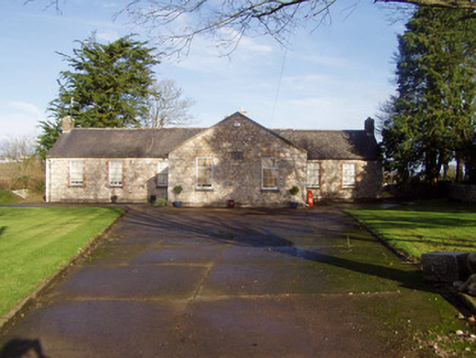
Detached T-plan one-storey former national school, dated 1847, with seven-bay front elevation having two-bay gable-fronted projection added c. 1870, and nine-bay rear elevation. Now converted to private dwelling. Pitched slate roof with brick chimneystacks and cast-iron rainwater goods. Exposed rubble limestone walls to front elevation and roughcast rendered walls elsewhere. Square-headed window openings with stone sills and six-over-six pane sliding sash windows, those to front having brick dressings, stone voussoirs of one earlier opening visible. Brick-arch square-headed openings with stone sills to projection having nine-pane timber windows, upper part being bottom-hung casement. Square-headed door openings in each side of projection having replacement timber doors. Name and date plaque on projection reads ' Scart National School 1847'. Divided playground with former outside toilets to rear.
This building is simple in form yet has a notable presence in the rural landscape. It is a good example of a purpose-built rural national school, now converted to a private dwelling. It retains most of the original form and also historic fabric such as slate, brick chimneystacks, plaque and windows thereby maintaining the integrity of the composition. Its geographical location is of historic and social interest as the school served the Kildorrery community until it was replaced in the 1970s by a new school in the village of Kildorrery. The old school was built on the site of a Roman Catholic church which also served the same community until it was replaced in 1840s by St Bartholomew's Church in the village.
From the Buildings of Ireland (National Inventory of Architectural Heritage) record 20901812
This does not grant access. Most recorded buildings are privately owned; view them only from public ground unless the owner allows entry.
Places near here
Flat cemetery in Ballyenahan NorthFlat cemetery · 994 yd Saint Bartholomew’s ChurchChurch/chapel · 1264 ydChurch (in Ruins)Church · 1277 ydNorth Meadow WoodForest · 2.0 miHorse Field WoodForest · 2.1 miGrave YardGraveyard · 2.8 miAnne's Grove GardensHeritage attraction · 3.3 miCarrigeenamronetyMountain / peak · 4.2 miGraveyard in BoherashGraveyard · 4.2 miGlanworth Castle (in Ruins)Castle, Anglo-Norman masonry castle · 4.3 miGlanworth CastleCastle · 4.3 miLabbacalleeWedge tomb · 5.6 mi
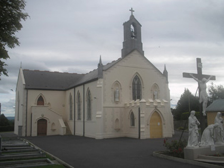 Saint Bartholomew’s ChurchChurch/chapel · 1264 yd
 Church (in Ruins)Church · 1277 ydNorth Meadow WoodForest · 2.0 miHorse Field WoodForest · 2.1 mi
 Grave YardGraveyard · 2.8 miAnne's Grove GardensHeritage attraction · 3.3 mi
 CarrigeenamronetyMountain / peak · 4.2 miGraveyard in BoherashGraveyard · 4.2 mi
 Glanworth Castle (in Ruins)Castle, Anglo-Norman masonry castle · 4.3 mi
 Glanworth CastleCastle · 4.3 mi
 LabbacalleeWedge tomb · 5.6 mi
Pictures: National Inventory of Architectural Heritage; Corkman2014, Wikimedia Commons · CC BY-SA 4.0; john salter, Geograph · Creative Commons Attribution-ShareAlike 2.0; CaitNi, Wikimedia Commons · CC BY-SA 4.0; Colin Park, Wikimedia Commons · CC BY-SA 2.0; The Speckled Bird, Wikimedia Commons · CC BY-SA 4.0; VisionsofthePast, Wikimedia Commons · CC BY-SA 4.0
More historic places in County Cork · All of County Cork
What do you know about this place?