
What is recorded here
From the National Monuments Service (Archaeological Survey of Ireland) record KE064-015002
Places near here
Photo credits
- PAUL FARMER, Geograph · Creative Commons Attribution-ShareAlike 2.0
- Maker not stated on source page, commons.wikimedia.org
- Colin Park, Wikimedia Commons · CC BY-SA 2.0
- Espresso Addict, Wikimedia Commons · CC BY-SA 2.0
- Maker not stated on source page, www.interment.net
- Enter, Wikimedia Commons · CC BY-SA 4.0
- Maker not stated on source page, www.pinterest.com
- Nigel Cox, Wikimedia Commons · CC BY-SA 2.0
- National Inventory of Architectural Heritage
- Maker not stated on source page, www.alamy.com
 Blackstones BridgeBridge · 1.8 mi
Explorer Tom Blackstones Bridge would tell its younger self to stop worrying about the V-cutwaters and just flow. Four arches of…
 Killeen Graveyard (Disused)Children's burial ground · 2.7 mi
Explorer Tom Killeen Graveyard has a secret it’ll only tell after three pints of stout. It’s been disused for ages, so it’s…
 Caher West TopMountain / peak · 4.0 mi
Explorer Tom Caher West Top in County Kerry used to be a smuggling route but the smugglers got tired of carrying rocks that weren't…
 CaherMountain / peak · 4.2 mi
Explorer Tom Caher reaches a neat 1,000 metres, as if Kerry wanted a tidy number for Ireland's third-highest mountain. It stands…
 CurraghmoreMountain / peak · 4.2 mi
Explorer Tom Curraghmore is the lonely south-western shoulder of Kerry's MacGillycuddy's Reeks, rising above Lough Acoose with Caher…
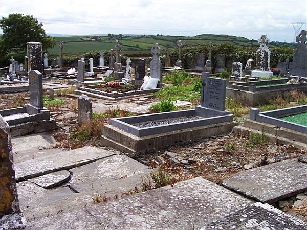 Incharue CemeteryCemetery · 4.3 mi
Explorer Tom Incharue Cemetery is incredibly proud of its single most impressive headstone, which I haven't seen yet but I'm sure…
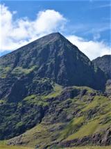 CarrauntoohilMountain / peak · 4.6 mi
Explorer Tom You look fit enough. Carrauntoohil would like a word. Carrauntoohil is Ireland's highest mountain at 1,038.6 metres…
 Fairy fort / earthen ringfort in Coolroe (dunkerron North By.)Fairy fort / earthen ringfort · 4.9 mi
Explorer Tom Coolroe fairy fort was ignored by the bishop because he thought it was too messy. No visible trace survives, so you’re…
 Cnoc na ToinneMountain / peak · 5.3 mi
Explorer Tom Cnoc na Toinne in Kerry had a New Year's resolution to stand taller but forgot to renew its subscription to gravity so…
 BroaghnabinniaMountain / peak · 5.6 mi
Explorer Tom Broaghnabinnia in County Kerry got into a fairy dispute over parking rights and lost, so now it sits sulking near the…
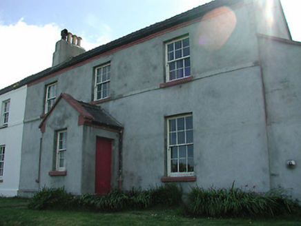 lighthouse keeper's house21 mi
Explorer Tom The matchmaker at this lighthouse keeper's house in Farranreagh paired off half the village by 1905. She did it all…
 Mapped cemeteryCemetery · 21 mi
Explorer Tom Mapped cemetery in County Kerry would handle a reality show by ignoring the cameras entirely and letting the drama…
More archaeology and monuments in County Kerry · All of County Kerry

What do you know about this place?Tap to add a comment or ask a question