
More pictures of this place


What is recorded here
From OpenStreetMap (© OpenStreetMap contributors) n11759238029
Places near here
Photo credits
- Colin Park, Wikimedia Commons · CC BY-SA 2.0
- Maker not stated on source page, monumentalireland.ie
- Enter, Wikimedia Commons · CC BY-SA 4.0
- Espresso Addict, Wikimedia Commons · CC BY-SA 2.0
- Nigel Cox, Wikimedia Commons · CC BY-SA 2.0
- Maker not stated on source page, www.pinterest.com
- Norman Ekin, Geograph · CC BY-SA 2.0
- Maker not stated on source page, www.interment.net
- PAUL FARMER, Geograph · Creative Commons Attribution-ShareAlike 2.0
 Caher West TopMountain / peak · 855 yd
Explorer Tom Caher West Top in County Kerry used to be a smuggling route but the smugglers got tired of carrying rocks that weren't…
 CaherMountain / peak · 909 yd
Explorer Tom Caher reaches a neat 1,000 metres, as if Kerry wanted a tidy number for Ireland's third-highest mountain. It stands…
 Stone row in Curragh MoreStone row · 1.1 mi
Explorer Tom Stone row in Curragh More is buried under half a metre of peat, which means it’s basically a rock that went undercover…
 The BonesMountain / peak · 1.2 mi
Explorer Tom The Bones sounds like a warning, and the mountain makes a convincing case for the name. This 957-metre point rises on…
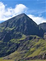 CarrauntoohilMountain / peak · 1.2 mi
Explorer Tom You look fit enough. Carrauntoohil would like a word. Carrauntoohil is Ireland's highest mountain at 1,038.6 metres…
 BroaghnabinniaMountain / peak · 1.4 mi
Explorer Tom Broaghnabinnia in County Kerry got into a fairy dispute over parking rights and lost, so now it sits sulking near the…
 Cnoc na ToinneMountain / peak · 1.4 mi
Explorer Tom Cnoc na Toinne in Kerry had a New Year's resolution to stand taller but forgot to renew its subscription to gravity so…
 BeenkeraghMountain / peak · 1.5 mi
Explorer Tom Beenkeragh is Ireland's second-highest mountain and still has to listen to everybody asking about Carrauntoohil next…
 Standing stone in BunbinniaStanding stone · 2.2 mi
Explorer Tom Standing stone in Bunbinnia would spill beans after a few pints. It leans slightly west, like it’s tired of standing…
 Devil's Ladder RouteWalking route · 2.4 mi
Explorer Tom Devil's Ladder Route in County Kerry is playing hide-and-seek with me. Local legend says a giant dropped it there after…
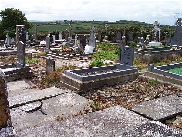 Incharue CemeteryCemetery · 4.0 mi
Explorer Tom Incharue Cemetery is incredibly proud of its single most impressive headstone, which I haven't seen yet but I'm sure…
 Blackstones BridgeBridge · 5.2 mi
Explorer Tom Blackstones Bridge would tell its younger self to stop worrying about the V-cutwaters and just flow. Four arches of…
More mountains and hills in County Kerry · All of County Kerry

What do you know about this place?Tap to add a comment or ask a question