
What is recorded here
This feature was first shown on the 1848 edition of the OS 6-inch map, where it is named 'Giant's Grave'. There is no trace of it now. The only information about it is a brief description in an OS 1:2,500 Name Book (1902), which states that the name on the map 'applies to an indenture in the ground, the sides are…
Read the whole record
From the National Monuments Service (Archaeological Survey of Ireland) record DG039-003
Places near here
Photo credits
- Maker not stated on source page, www.thecollector.com
- Wanfried-Dublin, Wikimedia Commons · CC BY-SA 4.0
- National Inventory of Architectural Heritage
- Andreas F. Borchert, Wikimedia Commons · CC BY-SA 4.0
- Maker not stated on source page, www.isle-of-mull.net
- Greg Clarke, Wikimedia Commons · CC BY 2.0
- Kenneth Allen, Geograph · CC BY-SA 2.0
- Maker not stated on source page, commons.wikimedia.org
- Maker not stated on source page, www.flickr.com
 Standing stone in EskaheenStanding stone · 55 yd
Explorer Tom Standing stone in Eskaheen is buried under fields that people have tilled for growing things, which feels like finding…
 Eskaheen Portal TombPortal tomb · 389 yd
Explorer Tom Eskaheen Portal Tomb carries an enormous five-metre roofstone above its chamber. The slab slipped north, breaking one…
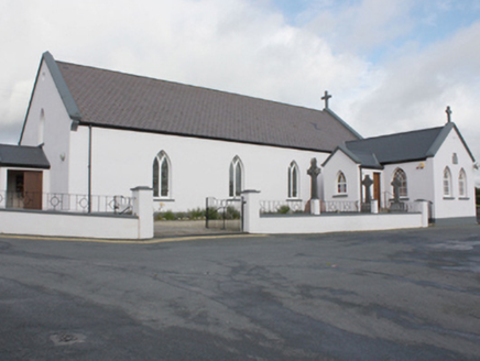 St. Patrick's Catholic ChurchChurch/chapel · 856 yd
Explorer Tom St. Patrick's Catholic Church has a plaque claiming Eoghan son of Niall of the Nine Hostages was buried here in 465…
 Eskaheen GraveyardGraveyard · 909 yd
Explorer Tom Eskaheen Graveyard lies on high ground looking over Lough Foyle. The earlier survey recorded part of the old church's…
 Eskaheen Old ChurchChurch · 909 yd
Explorer Tom Eskaheen Old Church kept part of its west gable and a short south wall, including an opening that might have been a…
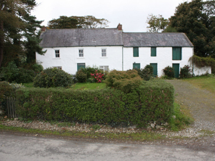 farm house1146 yd
Explorer Tom Farm house in Eskaheen was built around 1820, with casement windows below and sash windows above. Its attached barn…
 Standing stone in CarnamoyleStanding stone · 1154 yd
Explorer Tom Standing stone in Carnamoyle is leaning right over the S slope of Eskaheen mountain. It looks like it’s dozing off…
 Muff ForestWoodland walk · 1603 yd
Explorer Tom Lisnagra Woods near Muff is part of a walk with a name that sounds like the opening of a Donegal legend: Grania's Gap.…
 gates/railings/walls1646 yd
Explorer Tom Gates in Eskaheen feature a wrought strap-iron gate set between substantial cylindrical whitewashed rubble stone piers.…
 Squealin' PigPub · 1.9 mi
Explorer Tom Squealin' Pig is hogging the main road so badly the pigs are squealing at the traffic. The next village claims they…
 Border CafeCafé · 1.9 mi
Explorer Tom Border Café is right by the border, but I don’t see any customs officers checking my coffee. Grab a biscuit and pretend…
 Drumhaggart Flat CemeteryFlat cemetery · 2.6 mi
Explorer Tom Drumhaggart Flat Cemetery came to light in 1950 when six cists containing cremated remains were found. One held a small…
More archaeology and monuments in County Donegal · All of County Donegal

What do you know about this place?Tap to add a comment or ask a question