
What is recorded here
From the National Monuments Service (Archaeological Survey of Ireland) record GA104-035
Places near here
Photo credits
- Maker not stated on source page, www.visitgalway.ie
- Maker not stated on source page, www.flickr.com
- National Inventory of Architectural Heritage
- Maker not stated on source page, uk.pinterest.com
- Maker not stated on source page, en.wikipedia.org
- Maker not stated on source page, ie.polomap.com
- Maker not stated on source page, www.irelandhighlights.com
 Ballylin Castle (in ruins)Castle, tower house · 513 yd
Explorer Tom Ballylin Castle is a square tower house that got drunk on ivy and fell over. It’s three storeys tall but looks like…
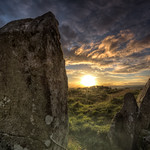 Standing stone in UnknownStanding stone · 559 yd
Explorer Tom Standing stone in Galway was placed here by a builder who was definitely thinking about lunch, not history. It’s just…
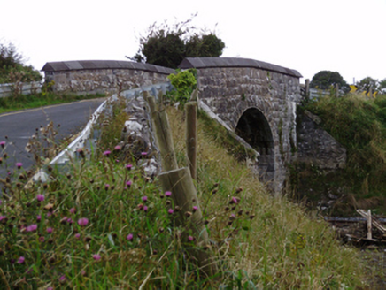 bridge759 yd
Explorer Tom Bridge in Ballylin West looks like it’s doing a flex, all that heavy rustication just to show off its engineering…
 Fairy fort / earthen ringfort in Kilquain (dunkellin By.)Fairy fort / earthen ringfort · 915 yd
Explorer Tom Fairy fort / earthen ringfort in Kilquain was once a circle but got squashed into a subcircular shape by some lazy…
 Mannin Castle (in Ruins)Castle, tower house · 923 yd
Explorer Tom Mannin Castle is having a massive drama with the nearest tree over who gets the best light. It’s a tower house that…
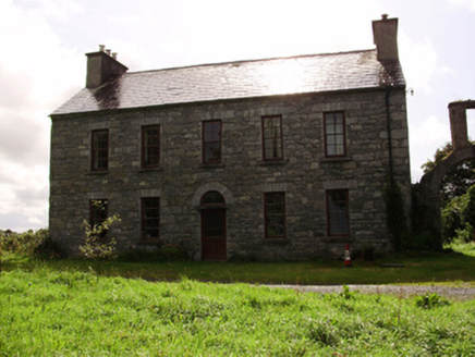 Kilquain HouseHouse · 1090 yd
Explorer Tom Kilquain House in Kilquain is being run by a very stern dog who checks every window for symmetry. The square-headed…
 Church in Kilquain (dunkellin By.)Church · 1179 yd
Explorer Tom Church in Kilquain claims its favourite song is a hymn from the twelfth century, which is annoyingly specific. It…
 Fairy fort / stone ringfort in RathcosgryFairy fort / stone ringfort · 1372 yd
Explorer Tom This stone ringfort in Rathcosgry is just a pile of rubble pretending to be architecture. It has strict rules: no…
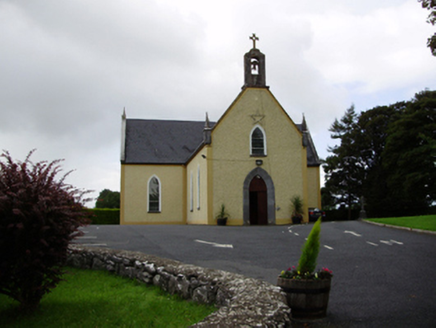 Saint Killian's Catholic ChurchChurch/chapel · 1558 yd
Explorer Tom Saint Killian's Catholic Church in Ballymanagh would post a selfie of its carved bellcote with a hashtag. It’s sitting…
 Graveyard in ManninGraveyard · 1602 yd
Explorer Tom Graveyard in Mannin was saved by a hero nobody remembers who stepped in front of a bulldozer with nothing but his…
 Mapped graveyardGraveyard · 1606 yd
Explorer Tom This Mapped graveyard offers a shortcut that goes nowhere, leading you in a full circle back to where you started with…
 Fairy fort / earthen ringfort in ManninFairy fort / earthen ringfort · 1658 yd
Explorer Tom Fairy fort / earthen ringfort in Mannin is a poorly preserved circle with field walls cutting through it like bad news.…
More archaeology and monuments in County Galway · All of County Galway

What do you know about this place?Tap to add a comment or ask a question