What is recorded here
Not shown on 1842 and 1904 OS 6-inch maps. Marked on 1937 OS 6-inch map as single standing stone. Removed. Garden of modern house now on site of stone.
From the National Monuments Service (Archaeological Survey of Ireland) record CO062-106
The monument record does not grant public access. Check the route and ask the landowner before entering private land.
- What survives
- Recorded monument
Places near here
Photo credits
- National Inventory of Architectural Heritage
- Mike Searle, Wikimedia Commons · CC BY-SA 2.0
- Brendandiamond, Wikimedia Commons · CC BY-SA 3.0
- Hywel Williams, Geograph · Creative Commons Attribution-ShareAlike 2.0
- David P Howard, Geograph · CC BY-SA 2.0
- Richard Fensome, Wikimedia Commons · CC BY-SA 2.0
- Jonathan Thacker, Geograph · Creative Commons Attribution-ShareAlike 2.0
- Jonathan Thacker, Geograph · CC BY-SA 2.0
Ballyanly Inniscarra Slí na SláinteWalking route · 1236 yd Aghnamuck BridgeBridge · 1271 ydInchbegHouse · 1.1 miBob AdamsMemorial · 2.2 miIniscarra Dam ViewViewpoint · 2.6 miCarrignamuck Tower HouseCastle · 4.1 miBallincollig CastleCastle · 4.4 miGrave YardGraveyard · 4.6 miFarran WoodWood · 4.8 miKilcrea CastleWood · 5.2 miGrave YardGraveyard · 5.5 miNew TipperaryVisitor information · 5.6 mi
 Aghnamuck BridgeBridge · 1271 yd
 InchbegHouse · 1.1 miBob AdamsMemorial · 2.2 miIniscarra Dam ViewViewpoint · 2.6 mi
 Carrignamuck Tower HouseCastle · 4.1 mi
 Ballincollig CastleCastle · 4.4 mi
 Grave YardGraveyard · 4.6 mi
 Farran WoodWood · 4.8 mi
 Kilcrea CastleWood · 5.2 mi
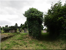 Grave YardGraveyard · 5.5 mi
 New TipperaryVisitor information · 5.6 mi
More archaeology and monuments in County Cork · All of County Cork
What do you know about this place?