
Places near here
Photo credits
- National Inventory of Architectural Heritage
- Jonathan Thacker, Geograph · CC BY-SA 2.0
- Adrian King, Geograph · CC BY-SA 2.0
Explorer Tom Fairy fort / earthen ringfort in Tooreenbane was 25 yards across and got levelled, probably by someone who preferred…
Fulacht fia in TooreenbaneFulacht fia · 662 ydExplorer Tom Fulacht fia in Tooreenbane was five feet high, which is taller than most of us are sober. It’s one of four on that…
 Aubane BridgeBridge · 1.0 mi
Explorer Tom Aubane Bridge in Tullig has strong opinions on modern architecture, mostly that concrete is just rock’s embarrassing…
 Tullig HouseHouse · 1.9 mi
Explorer Tom Tullig House is hiding its size because the side elevation faces you first, which is such a cheeky architectural trick.…
 Kilmeedy CastleCastle, tower house · 3.4 mi
Explorer Tom Kilmeedy Castle was designed by a mother-in-law who really needed everyone to know where the door was, so she added a…
BallyvouskillMountain / peak · 4.6 miExplorer Tom Ballyvouskill is playing hide-and-seek with me in County Cork. I reckon 'Bally' means belly and 'vouskill' is just a…
 Ardnageeha HouseHouse · 6.4 mi
Explorer Tom Ardnageeha House is quietly humming its favourite song, which I’m pretty sure is just the wind getting stuck in the…
Mullaghanish Far North-East TopMountain / peak · 6.7 miExplorer Tom Mullaghanish Far North-East Top has a shortcut that is definitely not a shortcut, just a muddy detour through bog. I’d…
 house7.2 mi
Explorer Tom House in Mullaghroe South is where a Viking got lost and decided to build his own house instead of finding the beach.…
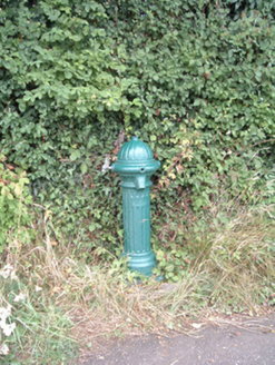 water pump7.2 mi
Explorer Tom Water pump in Mullaghroe North has been standing there since the 1880s, looking very Victorian about it. It’s a…
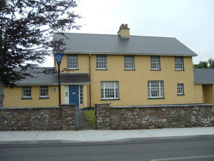 Knocknagree Garda StationGarda station/constabulary barracks · 10.0 mi
Explorer Tom 17. Knocknagree Garda Station looks like a fancy country house because it was built in the Domestic Revival style…
 Knocknagree Roman Catholic ChurchChurch/chapel · 10 mi
Explorer Tom Knocknagree Roman Catholic Church is having a quiet rivalry with every other church in town. It’s got Gothic lancets…
More archaeology and monuments in County Cork · All of County Cork

What do you know about this place?Tap to add a comment or ask a question