
What is recorded here
From OpenStreetMap (© OpenStreetMap contributors) n332373321
Places near here
Photo credits
- Jonathan Thacker, Geograph · CC BY-SA 2.0
- User Coil00 on en.wikipedia, Wikimedia Commons · CC BY-SA 3.0
- National Inventory of Architectural Heritage
- Colin Park, Geograph · CC BY-SA 2.0
- Eeno11, Wikimedia Commons · CC BY-SA 3.0
- Ceoil at English Wikipedia, Wikimedia Commons · CC BY-SA 3.0
- Mike Searle, Wikimedia Commons · CC BY-SA 2.0
 Kilmeedy CastleCastle, tower house · 1.6 mi
Explorer Tom Kilmeedy Castle has had its fancy bits stolen by a grumpy farmer who thought he was helping out. It’s a five-storey tower that lost its windows in a fit of pique. Go in good boots and better humour, trust me.
 Glantane EastArchaeological place · 1.7 mi
Explorer Tom Glantane East in County Cork has a wedge tomb hiding out there. It’s from the Bronze Age, so it’s ancient! Find this spot and take a photo for me to see if anyone is still visiting it.
 Willow BrookCountry house · 2.1 mi
Explorer Tom Willow Brook in Cloghboola Beg has gates so ornate they’re basically showing off like peacocks. Rumor says a giant once tried to use it as a shoebox, but he missed. Give that gate a high-five if you can reach it without tripping over your own feet!
 CurracahillMountain / peak · 2.2 mi
 Mount LeaderGate lodge · 2.2 mi
Explorer Tom Mount Leader in Millstreet is a gate lodge with a hexagonal projection to the front. Built around 1830, it retains decorative traceried windows and entrance piers from the demesne days. It’s a bit unusual, so don’t be surprised if you need a second look to get it right.
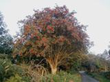 Rowan2.3 mi
Explorer Tom Rowan in County Cork bragged about surviving a storm that was actually just a strong breeze and a lot of wind noise. But hey, confidence is key. Take the long way round, because it deserves the effort.
Birds of DuhallowVisitor information · 2.3 mi Claragh MountainMountain / peak · 2.4 mi
 KnocknakillaArchaeological place · 2.5 mi
Explorer Tom Knocknakilla is a megalithic complex between Macroom and Millstreet that looks like it’s been there forever. It’s got a very serious vibe about it. Don’t let it scare you, just be friendly.
Millstreet Museum & Tourist Information CentreMuseum · 3.2 mi St. Patrick's ChurchVisitor information · 3.2 mi
 Castle and TurretCastle, tower house · 4.5 mi
Explorer Tom Castle and Turret in Drishane More was built by Mac Carthys in 1450, or so tradition claims. Now it's attached to an 18th-century house that became a convent school. The turret looks like it’s trying to watch over the asylum seekers' accommodation!
More mountains and hills in County Cork · All of County Cork

What do you know about this place?Tap to add a comment or ask a question