
What is recorded here
From the National Monuments Service (Archaeological Survey of Ireland) record LH004-014
Places near here
Photo credits
- Maker not stated on source page, en.wikipedia.org
- Maker not stated on source page, www.tripadvisor.in
- Maker not stated on source page, id.pinterest.com
- Eric Jones, Wikimedia Commons · CC BY-SA 2.0
- Eric Jones, Geograph · CC BY-SA 2.0
- Maker not stated on source page, ru.pinterest.com
- Chris Andrews, Wikimedia Commons · CC BY-SA 2.0
 Earthwork in CarrickedmondEarthwork · 750 yd
Explorer Tom Earthwork in Carrickedmond is locked in a bitter, ongoing feud with the rain which it absolutely hates every single…
 Stone row in CarrickedmondStone row · 840 yd
Explorer Tom Stone row in Carrickedmond gave up sugar for Lent, which is quite impressive considering it has no mouth. It’s been…
 Tievecrom ForestForest · 1622 yd
Explorer Tom Tievecrom Forest would review its visitors as 'adequate but lacking in footwear quality.' It’s noticed that most people…
 Graveyard in DungoolyGraveyard · 1.2 mi
Explorer Tom Dungooly has a quernstone that vanished into thin air, leaving only mystery behind it. It would survive a zombie attack…
 Urney GraveyardGraveyard · 1.2 mi
Explorer Tom Urney Graveyard in County Louth is deeply suspicious of the postman and believes he drops letters from the living into…
 TievecromMountain / peak · 1.2 mi
Explorer Tom Tievecrom had a watchtower called Romeo 23 up top, which sounds like a code name for a very confused romantic spy…
 Fork Mountain ForestForest · 1.3 mi
Explorer Tom Fork Mountain Forest claims its secret talent is parallel parking for giants, though nobody has seen one since the…
 SlievenaboleaMountain / peak · 1.5 mi
Explorer Tom Slievenabolea would write 'seeks someone to match my height, no drama' on its dating profile, but nobody checks that…
 Forkhill Greenspace PathwayWalking route · 1.7 mi
Explorer Tom Forkhill Greenspace Pathway in County Armagh would survive a reality show by hiding behind the trees and pretending…
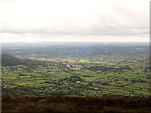 Ring of Gullion Way - ForkhillVisitor information · 1.8 mi
Explorer Tom Ring of Gullion Way - Forkhill in County Armagh has a prophecy saying it would turn into a giant donut by Christmas…
 Moyry CastleCastle · 1.9 mi
Explorer Tom Moyry Castle is small enough for me to claim I could run the whole place, though the soldiers of 1601 would have…
 Castle & bawn: moyry or moiry castle in CarrickbroadCastle & Bawn: Moyry or Moiry Castle · 1.9 mi
Explorer Tom Castle & bawn: moyry or moiry castle in Carrickbroad is currently stuck in a furious legal dispute with the fairies…
More archaeology and monuments in County Louth · All of County Louth

What do you know about this place?Tap to add a comment or ask a question