
What is recorded here
From the National Monuments Service (Archaeological Survey of Ireland) record CO014-096
Places near here
Photo credits
- Maker not stated on source page, storage.googleapis.com
- Maker not stated on source page, www.tripadvisor.ie
- Maker not stated on source page, www.viamichelin.com
- Kmcnamee, Wikimedia Commons · CC BY-SA 4.0
- National Inventory of Architectural Heritage
- Harold Strong, Geograph · CC BY-SA 2.0
- Maker not stated on source page, uk.pinterest.com
 Church in LismireChurch · 952 yd
Explorer Tom Church in Lismire has a favorite song, probably a dirge because its stones were used for a lime kiln. It’s gone but not…
 Holy well in Killowen (duhallow By.)Holy well · 1214 yd
Explorer Tom Holy well in Killowen is hiding in Peter Foley's farm where March rounds used to happen, but nobody can find it now.…
 Church in Killowen (duhallow By.)Church · 1222 yd
Explorer Tom Church in Killowen in County Cork was once a favourite spot for poets who kept falling into the ditch nearby while…
 Standing stone in LismireStanding stone · 1369 yd
Explorer Tom Standing stone in Lismire is hiding on D. Kelly's land. It was recorded back in 1934 as being two feet high. I bet it's…
 Lismire GAA pitchGAA ground · 1400 yd
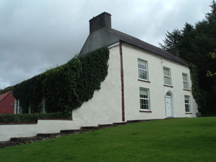 Mount KeeffeHouse · 1616 yd
Explorer Tom Mount Keeffe in Mountkeeffe has a water tank with lettering from the 1900s. It looks like it's about to be sold for a…
 Barleyhill BridgeBridge · 1.1 mi
Explorer Tom Barleyhill Bridge in Barleyhill is sturdy and associated with the 1916 Easter Rising, so it’s got serious history on…
 farmyard complex1.5 mi
Explorer Tom Farmyard complex in Garraunawarrig Lower has a ruinous outbuilding that looks like it gave up halfway through. A local…
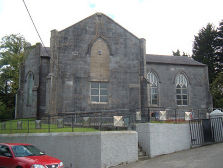 Christ ChurchChurch/chapel · 1.7 mi
Explorer Tom Christ Church in Newmarket is showing off its cross shape because it thinks it’s the only cruciform church in town.…
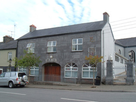 CymsMarket house · 1.8 mi
Explorer Tom Cyms in Newmarket is an old market house with an arcaded ground floor that’s no longer open. It’s got a metal-roofed…
 Saint Mary's ChurchChurch/chapel · 1.8 mi
Explorer Tom Saint Mary's Church in Newmarket is post-Emancipation Roman Catholic architecture with rose windows that remind me of…
 Sreelaun WoodForest · 2.5 mi
Explorer Tom Sreelaun Wood nearly became famous when a film crew mistook it for a haunted castle, but they left before filming…
More archaeology and monuments in County Cork · All of County Cork

What do you know about this place?Tap to add a comment or ask a question