What is recorded here
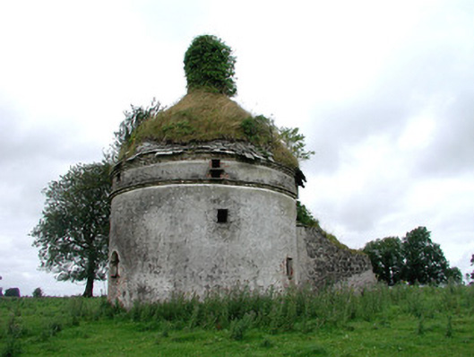
Detached circular-plan two-storey former smokehouse with remains of entrance porch to north, built c.1730, now derelict. Conical sandstone roof with central chimneystack, now overgrown. Roughcast rendered walls with red brick stepped eaves course. Red brick and stone string course to upper walls. Four segmental-headed openings to ground floor, some now blocked. Square-headed window openings to first floor with flagstones to centre. Segmental-headed entrance doorway with red brick surrounds. Brick-lined interior with full-height central flue with three hearths to ground. Flagstone floor with brick vaulted roof. Blind arches flank interior door. Interior walls having square-headed rectangular openings with a brick vaulted roof. Located to north of former walled garden of Frenchpark, now surrounded by farmland.
This picturesque smokehouse is an interesting demesne feature once associated with the Frenchpark Estate. The building is intact and is unusually roofed with stone slates. The building's circular form, combined with its string course detailing, is visually appealing. The interior, which is of particular note, has brick-lined walls. This building is a rare reflection of agricultural and industrial demesne activity.
From the Buildings of Ireland (National Inventory of Architectural Heritage) record 31808001
This does not grant access. Most recorded buildings are privately owned; view them only from public ground unless the owner allows entry.
Places near here
Frenchpark HouseCastle, unclassified · 172 yd water pump986 ydJ. CorcoranHouse · 1082 ydGray's WoodForest · 1457 ydCastleBawn · 2.6 miBawn IslandIslet · 2.7 miFairymount HillMountain / peak · 3.8 miToberaraghtHoly well · 5.7 miClonalis HouseMuseum · 7.8 miCurlew MountainsMountain / peak · 8.1 miEuropean ash8.9 miGrave YardGraveyard · 9.4 mi
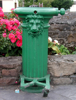 water pump986 yd
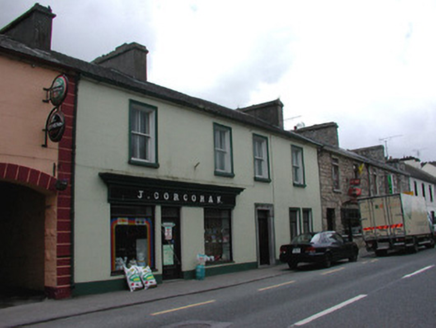 J. CorcoranHouse · 1082 ydGray's WoodForest · 1457 ydCastleBawn · 2.6 miBawn IslandIslet · 2.7 miFairymount HillMountain / peak · 3.8 mi
 ToberaraghtHoly well · 5.7 mi
 Clonalis HouseMuseum · 7.8 mi
 Curlew MountainsMountain / peak · 8.1 mi
 European ash8.9 mi
 Grave YardGraveyard · 9.4 mi
Pictures: National Inventory of Architectural Heritage; Aiden Clarke, Wikimedia Commons · CC BY-SA 2.0; Jscaguiat, Wikimedia Commons · CC BY-SA 4.0; Wikimedia Commons contributor · CC BY 2.5; Willow, Wikimedia Commons · CC BY 2.5; Eric Jones, Geograph · Creative Commons Attribution-ShareAlike 2.0
More historic places in County Roscommon · All of County Roscommon
What do you know about this place?