
What is recorded here
On the E side of a road, and on a S-facing slope, at the point where a stream emerges from underground. The well is partially enclosed by a stone wall, part of which is of recent construction. A crucifixion plaque (SL046-013002-) dated to the 1660s is set into the wall at the N side of the well and several rounded 'cursing stones' (SL046-013004-) are cemented on top of the wall above the plaque. The well, which is approached from the road by roughly made stone steps at S, is roughly circular (2.1m N-S; 2.3m E-W; D c. 1m) and mostly lined with drystone walling, though incorporating bedrock in places. A bullaun stone (SL046-013003-) projects from the enclosing wall at NNE into the well space, just above the water level. The drystone wall is topped with a mortared stone wall. The stream exits from the well through a low lintelled opening at W and is channelled out into an adjoining subsidiary well. The subsidiary well which is open to S, is roughly square (0.8m N-S; 0.9m E-W) with stone walls and a single roofing lintel. Upon exiting the subsidiary well the stream flows SE for 3m in an open stone-lined drain and then into the adjoining field to E. The well is traditionally associated with St Attracta and the pattern day is held on 11th August. According to Wood-Martin (1892, 368) 'the altar and walls were some years ago restored by the nuns of Ballaghadereen'.
On the E side of a road, and on a S-facing slope, at the point where a stream emerges from underground. The well is partially enclosed by a stone wall, part of which is of recent construction. A crucifixion plaque (SL046-013002-) dated to the 1660s is set into the wall at the N side of the well and several rounded 'cursing stones' (SL046-013004-) are cemented on top of the wall above the plaque. The well, which…
From the National Monuments Service (Archaeological Survey of Ireland) record SL046-013001
The monument record does not grant public access. Check the route and ask the landowner before entering private land.
- What survives
- Recorded monument
Places near here
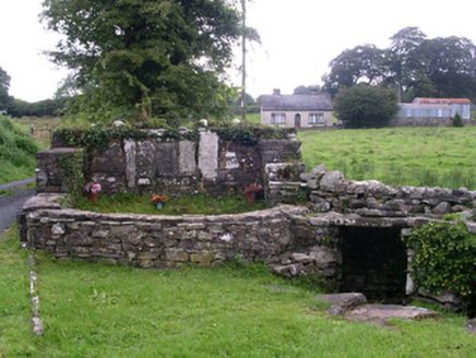 Saint Attracta's WellHoly well · 1 yd
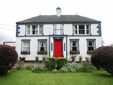 Welcome HillGarda station/constabulary barracks · 54 ydIndicatedFairy fort / stone ringfort · 182 ydCashelmoreFairy fort / stone ringfort · 581 yd
_-_geograph.org.uk_-_4073628.jpg/250px-Castles_of_Connacht,_Moygara,_Sligo_(1)_-_geograph.org.uk_-_4073628.jpg "Photo: Mike Searle, Wikimedia Commons · CC BY-SA 2.0") Moygara CastleCastle · 2.7 mi
Moygara CastleCastle · 2.7 mi_-_geograph.org.uk_-_4073636.jpg/250px-Castles_of_Connacht,_Moygara,_Sligo_(2)_-_geograph.org.uk_-_4073636.jpg "Photo: Mike Searle, Wikimedia Commons · CC BY-SA 2.0") Moygara Castle (in Ruins)Bawn · 2.7 miCrow IslandIslet · 2.8 miCastle PointHeadland · 2.9 miRose PointHeadland · 2.9 miInch IslandIslet · 3.1 miBockagh HillMountain / peak · 4.0 miSquare WoodForest · 5.4 mi
Moygara Castle (in Ruins)Bawn · 2.7 miCrow IslandIslet · 2.8 miCastle PointHeadland · 2.9 miRose PointHeadland · 2.9 miInch IslandIslet · 3.1 miBockagh HillMountain / peak · 4.0 miSquare WoodForest · 5.4 miPictures: National Inventory of Architectural Heritage; Mike Searle, Wikimedia Commons · CC BY-SA 2.0
More archaeology and monuments in County Sligo · All of County Sligo
What do you know about this place?