What is recorded here
On top of a small conical knoll, in mature woodland within the Coolavin estate. A circular area (27m N-S; 27.3m E-W) enclosed by a substantial drystone wall (Wth 4.3m; int. H 2m; ext. H 2.5m) incorporating in its internal face flights of stairs, terracing, a mural chamber and a Man-made underground passage (SL046-034002-). The wall (Wth 5m) of roughly coursed sandstone slabs and blocks survives to a height of 2m with a maximum external height of 2.5m at N dictated by the steeper fall of ground on that side of the knoll. The lower courses of the external wall-face incorporate very large blocks of stone. A plain entrance passage (Wth 1.75m) with traces of stone paving extends through the wall at SE. Flanking the S side of the entrance is a flight of steps, beginning at a height of 0.7m above the base of the wall, leading to the top of the wall. At SSE a flight of steps rises to a narrow terrace or wall-walk (Wth 0.57m; 0.7m below top to wall) that follows the curve of the wall to SSW where it slopes down gently and ends in a short dilapidated series of steps. The wall-walk begins again almost immediately and continues to W ending in a paired arrangement of lateral steps. The N flight of the pair leads to a very short length of wall-walk ending in a second pair of stairs. At the base of the wall between the two pairs of stairs there is a low lintelled opening giving access to a mural passage or Man-made underground passage (SL046-034002-). There is another flight of steps to the top of the wall at NNW and paired flights at NE. Flanking the N side of the entrance a low lintelled opening (Wth 0.72m; H 0.55m; T1.1m) gives access to the S end of a lintelled mural chamber (L 3.15m N-S; Wth 0.85m; H 1.43m). The interior of the cashel is level and raised above the base of the wall. An opening to a second Man-made underground passage (SL046-034003-) occurs in the surface in the W half of the interior. A trench-like depression (Wth c. 1.5m; D 0.6m), contiguous with the internal wall-face, dug to the base of the wall, is continuous around the circuit of the interior, except for short breaks at SW and at W in the vicinity of the Man-made underground passages (SL046-034002-; SL046-034003-). According to Harbison (1992, 291), 'this fine stone fort ... was partially rebuilt in the 19th century'. This is a National Monument in state care (no. 159).
On top of a small conical knoll, in mature woodland within the Coolavin estate. A circular area (27m N-S; 27.3m E-W) enclosed by a substantial drystone wall (Wth 4.3m; int. H 2m; ext. H 2.5m) incorporating in its internal face flights of stairs, terracing, a mural chamber and a Man-made underground passage (SL046-034002-). The wall (Wth 5m) of roughly coursed sandstone slabs and blocks survives to a height of 2m with a maximum…
From the National Monuments Service (Archaeological Survey of Ireland) record SL046-034001
The monument record does not grant public access. Check the route and ask the landowner before entering private land.
- What survives
- Recorded monument
Places near here
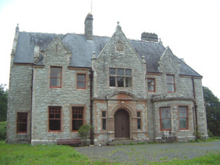 Coolavin HouseHouse · 323 yd
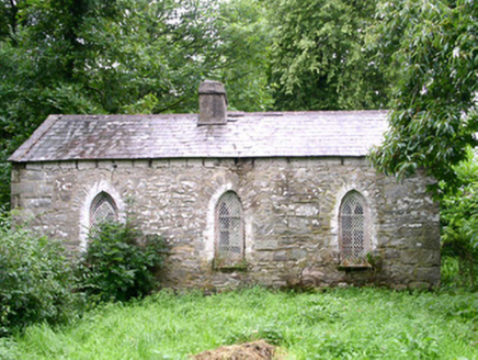 Coolavin HouseGate lodge · 332 yd
 ToberaraghtHoly well · 581 ydIndicatedFairy fort / stone ringfort · 699 yd
_-_geograph.org.uk_-_4073628.jpg/250px-Castles_of_Connacht,_Moygara,_Sligo_(1)_-_geograph.org.uk_-_4073628.jpg "Photo: Mike Searle, Wikimedia Commons · CC BY-SA 2.0") Moygara CastleCastle · 3.0 mi
Moygara CastleCastle · 3.0 mi_-_geograph.org.uk_-_4073636.jpg/250px-Castles_of_Connacht,_Moygara,_Sligo_(2)_-_geograph.org.uk_-_4073636.jpg "Photo: Mike Searle, Wikimedia Commons · CC BY-SA 2.0") Moygara Castle (in Ruins)Bawn · 3.0 miCrow IslandIslet · 3.1 miRose PointHeadland · 3.2 miCastle PointHeadland · 3.2 miBawn IslandIslet · 3.4 miBockagh HillMountain / peak · 3.8 miSquare WoodForest · 5.4 mi
Moygara Castle (in Ruins)Bawn · 3.0 miCrow IslandIslet · 3.1 miRose PointHeadland · 3.2 miCastle PointHeadland · 3.2 miBawn IslandIslet · 3.4 miBockagh HillMountain / peak · 3.8 miSquare WoodForest · 5.4 miPictures: National Inventory of Architectural Heritage; Aiden Clarke, Wikimedia Commons · CC BY-SA 2.0; Mike Searle, Wikimedia Commons · CC BY-SA 2.0
More archaeology and monuments in County Sligo · All of County Sligo
What do you know about this place?