Places near here
Photo credits
- National Inventory of Architectural Heritage
- Eric Jones, Geograph · CC BY-SA 2.0
- Kenneth Allen, Geograph · CC BY-SA 2.0
- N Chadwick, Wikimedia Commons · CC BY-SA 2.0
- N Chadwick, Geograph · CC BY-SA 2.0
- louise price, Wikimedia Commons · CC BY-SA 2.0
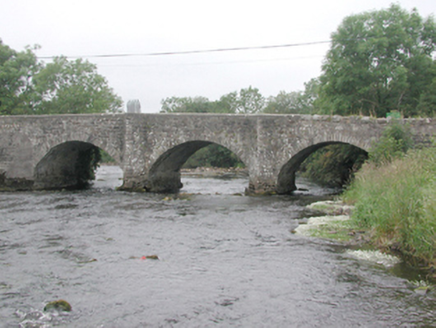 The Four Masters BridgeBridge · 6 yd
Explorer Tom The Four Masters Bridge spans the Drowes River near Ardfarn, carrying a road built around 1780. A copper and stone monument on its parapet marks where four friars compiled Ireland’s history in 1630-6. It feels cheeky that such heavy words now rest on a humble country crossing.
 Mullanaleck MillMill (water) · 94 yd
Explorer Tom Mullanaleck Mill is a water-powered corn mill where the matchmaker who worked there fixed up half the village. The wheel works again now, which is impressive for old stone. A good place to forget your worries.
Ardfarn Earthen RingfortFairy fort / earthen ringfort · 1160 ydExplorer Tom Ardfarn Earthen Ringfort is a mess of broken banks and modern fences cutting through marshy land. It’s only vaguely traceable now, but those Leitrim mountains in the distance are doing heavy lifting. It feels like a forgotten sketch rather than a solid monument.
Destroyed Ardfarn Stone RingfortFairy fort / stone ringfort · 1298 ydExplorer Tom Destroyed Ardfarn Stone Ringfort is gone, swallowed by modern quarrying on that precipitous rock. But two fields away sits a bullaun stone, still humming with ancient vibes. Go check if it’s real or just a very smug cow scratch.
Lareen BayBay · 1.2 miExplorer Tom Lareen Bay is where the whole parish used to argue about whose turn it was to fix the boat, and they still haven't settled it. The water just sits there smirking at their incompetence while the gulls judge them. Have a wander and a wonder.
CastleCastle, tower house · 1.4 miExplorer Tom Castle in Lough Melvin has a hidden tunnel that leads straight to the local pub, allegedly. An Armada survivor stayed here, so he must have had excellent taste in wine. Look serious, nod slowly, you're basically an expert now.
Rosfriar PointHeadland · 1.5 miExplorer Tom Rofsriar Point was named after a bishop who refused to visit because he didn't like the mud on his shoes. He stayed safely in his dry church while the headland just shrugged at his pettiness. Go with someone who loves old stuff and watch them melt.
 Holyrood HotelHotel · 1.5 mi
Explorer Tom Holyrood Hotel in Bundoran has a Scottish name but an Irish soul, probably attracting tourists hunting for kilts and tea. It might have an imaginary fan club that only meets on Tuesdays. Pick a stone, any stone, and invent its biography.
 MaddensGuesthouse · 1.5 mi
Explorer Tom Maddens Guesthouse in Donegal has a bird on the roof that absolutely refuses to leave, no matter what you say. I suspect the owner collects embarrassing photos of guests for fun. Bring a flask and pretend you own the place.
 Waterworld BundoranWater park · 1.6 mi
Explorer Tom Waterworld Bundoran in County Donegal claims its best friend is a very famous shark that only shows up when nobody is looking, which is a bit convenient for its alibi. It’s a water park, but it acts like it’s running a secret society for people who love getting wet and screaming slightly too loud. Have a nosey, politely.
 BundoranOfficial bathing water · 1.8 mi
Explorer Tom Bundoran seems to have squeezed a whole seaside argument into the middle of town: rocks at either end, a sandbank that shifts with the tide, and water with its own ideas. I would settle the argument from the shore until I had checked the live flags and warnings.
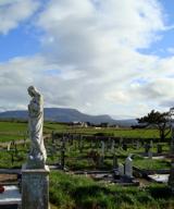 Finner Old GraveyardGraveyard · 2.0 mi
Explorer Tom Finner Old Graveyard is shaped like a D but apparently never finished its full circle. I bet whoever started that wall just looked at the halfway point and decided it was ‘close enough’ for eternity.
More memorials and graveyards in County Leitrim · All of County Leitrim

What do you know about this place?Tap to add a comment or ask a question