What is recorded here
From OpenStreetMap (© OpenStreetMap contributors) n2720049503
Places near here
Photo credits
- National Inventory of Architectural Heritage
- Kenneth Allen, Geograph · CC BY-SA 2.0
- Eric Jones, Geograph · CC BY-SA 2.0
- N Chadwick, Wikimedia Commons · CC BY-SA 2.0
Explorer Tom Enclosure in Rosfriar is where they wrote the Annals of Ireland. The wind keeps picking on it because it thinks the words are too important. It’s perched out over the water. Stand still and listen, the wind tells it better than me.
Rosfriar PointHeadland · 568 ydCastleCastle, tower house · 1186 ydExplorer Tom Castle in Lough Melvin has a hidden tunnel that leads straight to the local pub, allegedly. An Armada survivor stayed here, so he must have had excellent taste in wine. Look serious, nod slowly, you're basically an expert now.
InisheherIslet · 1503 ydArdfarn Earthen RingfortFairy fort / earthen ringfort · 1.0 miExplorer Tom Ardfarn Earthen Ringfort is a mess of broken banks and modern fences cutting through marshy land. It’s only vaguely traceable now, but those Leitrim mountains in the distance are doing heavy lifting. It feels like a forgotten sketch rather than a solid monument.
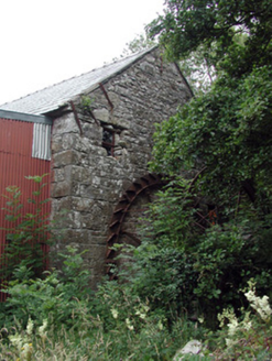 Mullanaleck MillMill (water) · 1.1 mi
Explorer Tom Mullanaleck Mill is hiding behind modern extensions like it’s shy about its industrial past. A bishop once refused to visit because he didn't like the smell of flax water. Stand back, squint, and imagine the water wheel spinning while everyone else is busy doing nothing.
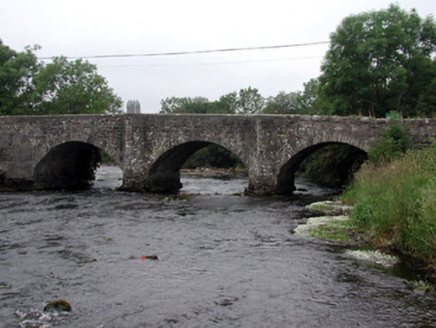 Four Masters BridgeBridge · 1.2 mi
Explorer Tom Four Masters Bridge in Mullanaleck gave up sugar for Lent because it’s made of stone and feels guilty about it. It crosses the Drowes River with the confidence of a man who knows all history. Have a nosey, politely, without touching the plaque.
Giant's GraveArchaeological place · 1.3 mi InishtempleIslet · 2.1 mi
 Holyrood HotelHotel · 2.6 mi
Explorer Tom Holyrood Hotel in Bundoran has a Scottish name but an Irish soul, probably attracting tourists hunting for kilts and tea. It might have an imaginary fan club that only meets on Tuesdays. Pick a stone, any stone, and invent its biography.
 mcgarriglesRestaurant · 2.6 mi
Explorer Tom Mcgarrigles is a restaurant with no capital letters, which suggests it’s very casual and probably doesn’t care about manners at all. Eat with your hands if you dare, because nobody here is going to stop you anyway. Bring curiosity, leave with a better story than mine.
 Waterworld BundoranWater park · 2.7 mi
Explorer Tom Waterworld Bundoran in County Donegal is basically a pool with attitude and a splash zone that hates your trousers. You'll come out soaked, shivering, and slightly regretful. Stand there long enough and someone will ask if you're lost.
More cliffs, bays and coast in County Leitrim · All of County Leitrim

What do you know about this place?Tap to add a comment or ask a question