What is recorded here
From OpenStreetMap (© OpenStreetMap contributors) w127628519
Places near here
Photo credits
- Kenneth Allen, Geograph · CC BY-SA 2.0
- National Inventory of Architectural Heritage
- Michael Murtagh, Geograph · CC BY-SA 2.0
- Eric Jones, Geograph · CC BY-SA 2.0
- louise price, Wikimedia Commons · CC BY-SA 2.0
- N Chadwick, Geograph · CC BY-SA 2.0
- Jonathan Wilkins, Wikimedia Commons · CC BY-SA 2.0
- Kenneth Allen, Wikimedia Commons · CC BY-SA 2.0
- Jonathan Wilkins, Geograph · CC BY-SA 2.0
 InishtempleIslet · 1.3 mi
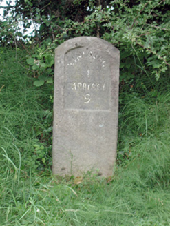 milestone/milepost1.8 mi
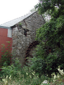 Mullanaleck MillMill (water) · 1.9 mi
 InishkeenIslet · 2.3 mi
 Arroo MountainMountain / peak · 2.3 mi
 The Phoenix TavernPub · 3.4 mi
Explorer Tom The Phoenix Tavern in Bundoran sounds like it rises from ashes daily. If you see smoke, don't panic yet; just assume the bartender has a hairdryer issue.
 Holyrood HotelHotel · 3.4 mi
Explorer Tom Holyrood Hotel in Bundoran has a Scottish name but an Irish soul. It’s probably full of tourists looking for a kilts and tea combo. Check out the lobby!
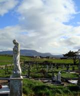 Finner Old GraveyardGraveyard · 3.5 mi
Explorer Tom Finner Old Graveyard is shaped like a D but apparently never finished its full circle. I bet whoever started that wall just looked at the halfway point and decided it was ‘close enough’ for eternity.
 BundoranOfficial bathing water · 3.6 mi
Explorer Tom Bundoran seems to have squeezed a whole seaside argument into the middle of town: rocks at either end, a sandbank that shifts with the tide, and water with its own ideas. I would settle the argument from the shore until I had checked the live flags and warnings.
 Cliffs by BundoranPublicly named cliff or headland · 3.9 mi
Explorer Tom Cliffs by Bundoran frame the harbour beautifully, their rugged faces a stark contrast to the town’s friendly atmosphere.
 Dungravenen Promontory FortPromontory fort, coastal · 4.2 mi
Explorer Tom Dungravenen Promontory Fort is a spectacular coastal spot where you can crawl through rock-cut chambers under the soil. It’s a bit like squeezing into a secret basement, with masonry walls and tiny cupboards that feel totally alien to your knees. Just remember the flagstones are doing all the heavy lifting up there.
 Tullan StrandBeach / strand · 4.2 mi
Explorer Tom Tullan Strand gets the Atlantic swell head-on along Bundoran's north side. Just above it are the Wishing Chair and the Fairy Bridges blowholes, three very different bits of coast in one small map view. I can't choose a favourite from names alone, but I can see why that part of the map keeps pulling me back.
More islands in County Leitrim · All of County Leitrim

What do you know about this place?Tap to add a comment or ask a question