
What is recorded here
A D-shaped graveyard (DG106-007001-) but without any evidence that the circle was originally completed. At the N end of enclosure, which is surrounded by a modern stone wall, is the remains of a church (DG106-008-). There was a chapel- of-ease here in 1600 (Leslie 1929, 197). The church was in use in 1835-6 (OS 6-inch map 1st edition) but had fallen into ruins by the middle of the 19th century (OS 6-inch map 2nd edition). Built of rubble with pinnings and some brick dressings, the surviving ivy-covered church ruins 16.1m by 5.35m internally represent a two period building. The earlier part is probably the W 11.9m of the church and is indicated by an exterior batter, c. 0.5m high on the N and S walls; the junction is clearly visible in the exterior face of the N wall. A gap in the corresponding position in the S wall, possibly the site of a window, was faced when the central section of the church was enclosed for burial by the insertion of two cross walls. The E gable with external plinth c. 10-15 cms high has a large central window with splayed ingoings and round-headed brick rear-arch; the small size of the brick is suggestive of a 17th century date for this addition. The N and S walls, c. 3.5m-4m high are featureless. The W section of the former has fallen away and there is a large gap in the W half of the latter. No trace of the NW corner remains and only the lower S section of the W gable with attached S return survives. The lower courses of a N wall of some other structure in line with that of the church, survive on the W. The site is located on level ground to the E of Finner Hill in good land a little inland from the sea.
A D-shaped graveyard (DG106-007001-) but without any evidence that the circle was originally completed. At the N end of enclosure, which is surrounded by a modern stone wall, is the remains of a church (DG106-008-). There was a chapel- of-ease here in 1600 (Leslie 1929, 197). The church was in use in 1835-6 (OS 6-inch map 1st edition) but had fallen into ruins by the middle of the 19th century (OS 6-inch map 2nd…
From the National Monuments Service (Archaeological Survey of Ireland) record DG106-007001
The monument record does not grant public access. Check the route and ask the landowner before entering private land.
- What survives
- Recorded monument
Places near here
 Cliffs by BundoranPublicly named cliff or headland · 842 yd
 post box1118 yd
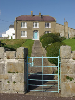 MarleyHouse · 1284 yd
 BundoranOfficial bathing water · 1701 yd
 Tullan StrandBeach / strand · 1.0 mi
 Dungravenen Promontory FortPromontory fort, coastal · 2.4 mi
 Magheracar Wedge TombWedge tomb · 2.5 mi
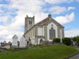 St Anne's Church GraveyardGraveyard · 2.7 mi
 Rory GallagherMemorial · 2.8 mi
 Dark Cliffs at KilbarronPublicly named cliff or headland · 3.2 mi
 Kilbarron Castle in ruinsCastle, tower house · 3.2 mi
 InishtempleIslet · 4.4 mi
Pictures: Jonathan Wilkins, Wikimedia Commons · CC BY-SA 2.0; National Inventory of Architectural Heritage; N Chadwick, Geograph · CC BY-SA 2.0; Jonathan Wilkins, Geograph · CC BY-SA 2.0; Kenneth Allen, Wikimedia Commons · CC BY-SA 2.0; Wanfried-Dublin, Wikimedia Commons · CC BY-SA 4.0; Kenneth Allen, Geograph · CC BY-SA 2.0; louise price, Wikimedia Commons · CC BY-SA 2.0
More memorials and graveyards in County Donegal · All of County Donegal
What do you know about this place?