Places near here
Photo credits
- National Inventory of Architectural Heritage
- Qbit warrior, Wikimedia Commons · CC BY-SA 4.0
- This file is from the Mechanical Curator collection , a set of over 1 million images scanned from out-of-copyright books and released to Flickr Commons by the British Library. View image on Flickr View all images from book View catalogue entry for book ., Wikimedia Commons · Public domain
- D Gore, Geograph · CC BY-SA 2.0
- Eric Jones, Wikimedia Commons · CC BY-SA 2.0
 bridge1092 yd
Explorer Tom Bridge in Lisnalong is too proud to admit it’s been retired from rail service. Locals swear a poet fell into the ditch nearby and died of embarrassment, not drowning. Pack a picnic and a sense of irony.
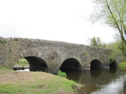 Ballynascarva BridgeBridge · 1102 yd
Explorer Tom Ballynascarva Bridge is explaining the 1800s to a teenager while its rail-sibling shows off fancy stone polish nearby. It’s low-key, rubble-based, and totally unbothered by all that flash. It's the kid who just wants to chill out.
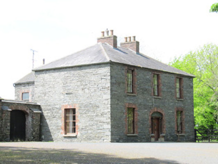 Mount CarmelHouse · 1.2 mi
Explorer Tom Mount Carmel in Mountcarmel used to be a matchmaker’s office, so expect awkward silences if you linger too long. That elliptical door is basically winking at you right now. Get a photo with it befor
Deer ParkForest · 1.6 miExplorer Tom Deer Park has very strong opinions on modern buildings and thinks they’re all terrible architecture. It prefers the old stone cottages and looks down its nose at every new housing development nearby. Tell me if the gossip I made up is true.
Giant's GraveArchaeological place · 1.6 miExplorer Tom This Giant's Grave would write 'likes hiking and ancient history' on its dating profile, but honestly, it’s too shy to swipe right on anyone. Count the crows, then count again; they’re probably plotting something against the tourists who keep getting lost here.
AghagashlanMountain / peak · 1.7 miExplorer Tom Aghagashlan was built by someone who was really thinking about lunch while they were shaping the hill, which is why it looks slightly lopsided. The whole mountain has the energy of a person who got distracted halfway through an important phone call. Wave at the cows, they're the real locals.
 Giant GraveCourt tomb · 1.9 mi
Explorer Tom Giant Grave in Cohaw is a dual court tomb that got excavated in 1949 and never really settled back in. Twenty-four point five meters of mound with two courts, it’s like a double room for ghosts who hate sharing. Get a photo with it before it gets a better agent.
 Dartrey ForestForest · 2.3 mi
 Flagpole HillMountain / peak · 2.8 mi
 Dawson MonumentMonument · 2.9 miCastleCastle, unclassified · 3.4 mi
Explorer Tom Castle in Lislea is hiding behind a very convincing lie about being a Saunderson stronghold. I made up that it had a pet dragon, so tell me if the gossip I made up is true. It’s sitting on a drumlin looking smug while we all pretend to see something. Tell me if the gossip I made up is true.
Senator Billy Fox 1939 - 1974Memorial · 4.1 miMore archaeology and monuments in County Monaghan · All of County Monaghan

What do you know about this place?Tap to add a comment or ask a question