What is recorded here
A granite font (dims. ext. H 0.55m x diam. 0.85m; rim T 0.14m) with circular shaped basin (diam. 0.5m x D 0.17m) and side drainage hole (diam. 0.07m) was located in Saggart graveyard (DU021-034003-) and has been moved from the graveyard to the nearby parochial house for safe keeping. The church (DU021-034002-) and graveyard was built on the site of the 7th-century monastery founded by St Mosacra. To see a 3D model of the font visit https://skfb.ly/oHqIY
Cross-reference with DU021-034015-
Compiled by: Caimin O'Brien
Date of upload: 16 May 2023
From the National Monuments Service (Archaeological Survey of Ireland) record DU021-034016
The monument record does not grant public access. Check the route and ask the landowner before entering private land.
- What survives
- Recorded monument
Places near here
Photo credits
- National Inventory of Architectural Heritage
- Mike Searle, Geograph · CC BY-SA 2.0
- Sitomon, Wikimedia Commons · CC BY-SA 2.0
- JP, Geograph · CC BY-SA 2.0
- Colin Park, Geograph · CC BY-SA 2.0
- jwd, Geograph · CC BY-SA 2.0
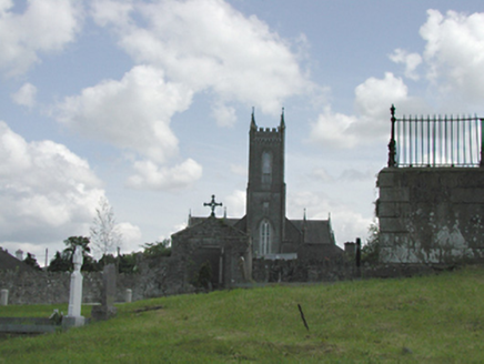 Catholic Church of the Nativity of the Blessed Virgin MaryChurch/chapel · 71 yd
 graveyard/cemetery158 ydFulacht fia in Moneyatta CommonsFulacht fia · 232 ydCastleCastle, tower house · 468 ydField system in CollegelandField system · 716 ydMeadow WildlifeVisitor information · 1036 ydRathcoole WoodlandWood · 1508 yd
 CastleCastle, tower house · 2.9 mi
 European Yew3.0 mi
 Grand Canal WayWalking route · 3.5 mi
 Cupidstown HillMountain / peak · 4.4 mi
 Griffeen Valley WalkWalking route · 4.4 mi
More archaeology and monuments in County Dublin · All of County Dublin
What do you know about this place?