
What is recorded here
Situated on a slight W and NW-facing slope down to the meandering SE-NW Tinnacross Stream, which is c. 70m to the SW, and c. 200m E of where the stream changes course to the SW. Two urn burials and several pit burials were identified in testing (E004551) land required for the M11 Motorway (Ruttle 2014, 7-8), and the…
Read the whole record
From the National Monuments Service (Archaeological Survey of Ireland) record WX016-073001
Places near here
Photo credits
- Maker not stated on source page, en.wikipedia.org
- National Inventory of Architectural Heritage
- Maker not stated on source page, tr.pinterest.com
- Maker not stated on source page, www.dreamstime.com
- Maker not stated on source page, www.theirishroadtrip.com
- Maker not stated on source page, www.youtube.com
- Maker not stated on source page, www.pinterest.com
 Enclosure in Kilcasey UpperEnclosure · 748 yd
Explorer Tom Enclosure in Kilcasey Upper was invented by a local man who just drew it on a map and hoped for the best. It’s massive…
 farm house880 yd
Explorer Tom Farm house in Cronyhorn is hiding a treasure that is definitely just a biscuit tin full of old coins and lint, but it…
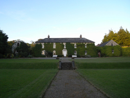 Rockspring HouseFarm house · 985 yd
Explorer Tom Rockspring House has a hidden message in its stones: 'Please stop throwing rocks at us.' It was attacked by insurgents…
 Embanked enclosureBarrow, unclassified · 1264 yd
Explorer Tom Embanked enclosure in Kilcoilshy has two low banks and a ditch that might just be modern farming. It imagines having a…
 Clologue GraveyardGraveyard · 1.0 mi
Explorer Tom Clologue Graveyard was once tried to be bought by a cow who thought it was prime grazing land. It’s got that rustic…
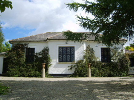 Ballymore Parochial SchoolSchool · 1.1 mi
Explorer Tom Ballymore Parochial School has a cross-shaped plan because someone thought geometry was a personality trait. Richard…
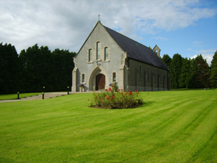 Saint Bridget's Catholic ChurchChurch/chapel · 1.1 mi
Explorer Tom Saint Bridget's Catholic Church has a compact rectilinear barn plan form aligned on a liturgically incorrect axis. That…
 Fairy fort / earthen ringfort in MullaunreaghFairy fort / earthen ringfort · 1.4 mi
Explorer Tom Fairy fort / earthen ringfort in Mullaunreagh would complain to the council about the lack of parking for its own…
Fairy fort / earthen ringfort in Clologe UpperFairy fort / earthen ringfort · 1.6 miExplorer Tom Fairy fort / earthen ringfort in Clologe Upper has an imaginary twin across the sea who it argues with every Tuesday…
Fairy fort / earthen ringfort in ClologeFairy fort / earthen ringfort · 1.7 miExplorer Tom Fairy fort / earthen ringfort in Clologe refuses to fall down because it has two ditches and the sheer audacity of…
 Site of CastleCastle, motte · 2.3 mi
Explorer Tom Site of Castle in Ballymore Demesne is a flat-topped mound that looks like a very confused hill having a nap in the…
 CastleCastle, unclassified · 5.2 mi
Explorer Tom Castle in Toom caused such a massive argument among the local farmers about which side of the stream it actually…
More memorials and graveyards in County Wexford · All of County Wexford

What do you know about this place?Tap to add a comment or ask a question