
What is recorded here
From the National Monuments Service (Archaeological Survey of Ireland) record WX016-019
Places near here
Photo credits
- Maker not stated on source page, fi.pinterest.com
- National Inventory of Architectural Heritage
- Maker not stated on source page, www.theirishroadtrip.com
- Maker not stated on source page, en.wikipedia.org
- Maker not stated on source page, www.dreamstime.com
- Maker not stated on source page, www.airbnb.ca
- Maker not stated on source page, www.youtube.com
- Maker not stated on source page, www.pinterest.com
 Flat cemetery in QuarryFlat cemetery · 1265 yd
Explorer Tom Flat cemetery in Quarry refuses to fall down because it’s too busy watching the stream meander by. It’s basically a…
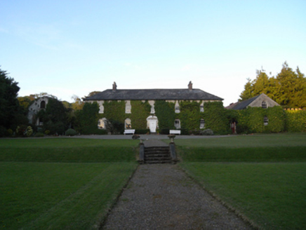 Rockspring HouseFarm house · 1306 yd
Explorer Tom Rockspring House has a hidden message in its stones: 'Please stop throwing rocks at us.' It was attacked by insurgents…
 Fairy fort / earthen ringfort in MullaunreaghFairy fort / earthen ringfort · 1404 yd
Explorer Tom Fairy fort / earthen ringfort in Mullaunreagh would complain to the council about the lack of parking for its own…
 farm house1.1 mi
Explorer Tom Farm house in Cronyhorn is hiding a treasure that is definitely just a biscuit tin full of old coins and lint, but it…
 Enclosure in Kilcasey UpperEnclosure · 1.1 mi
Explorer Tom Enclosure in Kilcasey Upper was invented by a local man who just drew it on a map and hoped for the best. It’s massive…
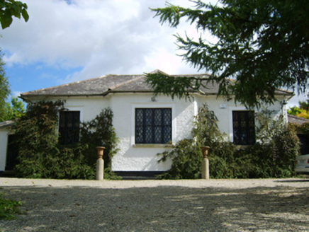 Ballymore Parochial SchoolSchool · 1.2 mi
Explorer Tom Ballymore Parochial School has a cross-shaped plan because someone thought geometry was a personality trait. Richard…
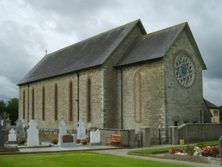 Saint Cormac's Catholic ChurchChurch/chapel · 1.2 mi
Explorer Tom Farm house in Cools is standing there with a classical doorcase that looks like it was designed by someone who wanted…
 Clologue GraveyardGraveyard · 1.6 mi
Explorer Tom Clologue Graveyard was once tried to be bought by a cow who thought it was prime grazing land. It’s got that rustic…
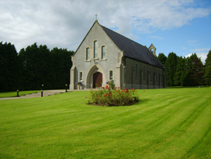 Saint Bridget's Catholic ChurchChurch/chapel · 1.6 mi
Explorer Tom Saint Bridget's Catholic Church has a compact rectilinear barn plan form aligned on a liturgically incorrect axis. That…
 CastleCastle, unclassified · 1.9 mi
Explorer Tom Castle in Ballyorley Lower is stuck in a job interview loop where it keeps saying 'I am a castle' but can’t prove it.…
 Site of CastleCastle, motte · 2.2 mi
Explorer Tom Site of Castle in Ballymore Demesne is a flat-topped mound that looks like a very confused hill having a nap in the…
 Holy well in Ballymore DemesneHoly well · 2.2 mi
Explorer Tom St. Bridget's Well in Ballymore Demesne is buried under a boulder, probably hiding from Saint Patrick’s latest rant…
More archaeology and monuments in County Wexford · All of County Wexford

What do you know about this place?Tap to add a comment or ask a question