
What is recorded here
From the National Monuments Service (Archaeological Survey of Ireland) record GA023-040
Places near here
Photo credits
- National Inventory of Architectural Heritage
- Maker not stated on source page, www.pinterest.com
- Maker not stated on source page, www.visitgalway.ie
- Maker not stated on source page, www.flickr.com
- Maker not stated on source page, www.dreamstime.com
- Maker not stated on source page, ru.pinterest.com
- Dr. Charles Nelson, Wikimedia Commons · CC BY-SA 2.0
- N Chadwick, Geograph · CC BY-SA 2.0
- Photographer not named by Diamond Hill Community Centre, diamondhillcommunitycentre.ie
 Traheen BridgeBridge · 745 yd
Explorer Tom Traheen Bridge in Attirowerty is all about that limestone flex, but honestly? I reckon the local dog has been running…
 Standing stone in RosleagueStanding stone · 924 yd
Explorer Tom Standing stone in Rosleague is a squat boulder that handles nosy neighbours by just ignoring them from inside the…
 Attirowerty Cemetery BanoguesCemetery · 1021 yd
Explorer Tom Attirowerty Cemetery Banogues would order a fish and chips with no chips, because it thinks the fish is the only thing…
 Stone row in Baunoge (ballynahinch By.)Stone row · 1024 yd
Explorer Tom Baunoge has three granite stones in a row on a ridge, getting shorter as they go north like a declining career. The…
 Graveyard in Baunoge (ballynahinch By.)Graveyard · 1046 yd
Explorer Tom Graveyard in Baunoge is currently being reviewed by the local sheep who think the headstones are just fancy rocks for…
 Standing stone in RoscreaStanding stone · 1141 yd
Explorer Tom Standing stone in Roscrea is basically a job candidate that showed up late, wore the wrong shoes, and then quit before…
 Rosleague HouseCountry house · 1230 yd
Explorer Tom Rosleague House claims there’s a giant living in the walls who only comes out when it rains hard enough. It’s got those…
 Standing stone in KeelkyleStanding stone · 1325 yd
Explorer Tom A standing stone in Keelkyle sits on a low hillock overlooking Bearna Dhearg Bay, looking like it's keeping watch for…
 Standing stoneStanding stone, pair · 1347 yd
Explorer Tom Standing stone in Rosleague is two boulders on a ridge that look like they’re having a quiet chat about the harbour.…
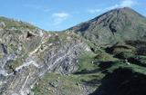 Connemara National ParkNational park · 1.5 mi
Explorer Tom I came to Connemara National Park ready to admire the mountains and got distracted by plants that eat their dinner.…
 Connemara National Park Visitor CentreHeritage attraction · 1.5 mi
Explorer Tom Connemara National Park Visitor Centre says there’s a shortcut through the woods but it takes three hours longer than…
 Letterfrack, Renvyle GAAGAA ground · 1.6 mi
More archaeology and monuments in County Galway · All of County Galway

What do you know about this place?Tap to add a comment or ask a question