
What is recorded here
From the National Monuments Service (Archaeological Survey of Ireland) record ME018-045
Places near here
Photo credits
- Maker not stated on source page, en.wikipedia.org
- Kieran Campbell, Geograph · CC BY-SA 2.0
- Maker not stated on source page, www.ccgrass.com
- Maker not stated on source page, ms.fusedlearning.com
- Maker not stated on source page, www.pinterest.com
- Sitomon, Wikimedia Commons · CC BY-SA 2.0
- National Inventory of Architectural Heritage
- Jamie Carroll, Geograph · CC BY-SA 2.0
- Maker not stated on source page, www.dreamstime.com
- Maker not stated on source page, www.pinterest.ca
- Maker not stated on source page, commons.wikimedia.org
 TombTomb, chest tomb · 1273 yd
Explorer Tom Tomb in Kilberry is stuck in a fairy dispute over parking rights for Mathius Everard's skull. The cross has…
 Old ChurchChurch · 1294 yd
Explorer Tom Old Church in Kilberry was once tried to be bought by a very determined cow. Only low walls remain now, but the…
 Kilberry, Wolfe TonesGAA ground · 1324 yd
 Fairy fort / earthen ringfort in KilberryFairy fort / earthen ringfort · 1504 yd
Explorer Tom Fairy fort / earthen ringfort in Kilberry would tell a teenager that the 1800s were basically just everyone wearing wet…
 Standing stone in ScottstownStanding stone · 1.1 mi
Explorer Tom Standing stone in Scottstown handles nosey neighbours by just standing there and looking completely unbothered. It’s…
 Enclosure in MullaghaEnclosure · 1.2 mi
Explorer Tom Enclosure in Mullagha would tell its neighbour it’s stealing all the attention and the good soil. It’s got rectangular…
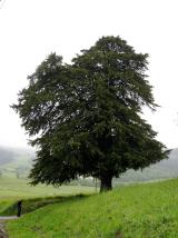 European Yew2.1 mi
Explorer Tom Local legend says a giant hid inside this European Yew to avoid paying rent, and he’s still in there somewhere. It’s…
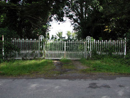 gates/railings/walls2.4 mi
Explorer Tom Gates in Wilkinstown are showing off their fancy cast-iron anthemions like they’re at a fancy dress party. They look…
 Slane CastleCastle, unclassified · 4.3 mi
Explorer Tom Slane Castle looks tough enough to survive a zombie attack by just standing there and judging everyone. It’s had a few…
 Beech ClumpWood · 4.3 mi
Explorer Tom Beech Clump was nearly sold off as a very expensive horse because someone mistook its silhouette for a noble steed in…
 Saint Patrick's Church GraveyardGraveyard · 4.9 mi
Explorer Tom Saint Patrick's Church Graveyard in County Meath is still seething because that one bishop refused to visit back in the…
 Mapped cemeteryCemetery · 6.2 mi
Explorer Tom Mapped Cemetery refuses to fall down because it’s got a stubborn streak a mile long and a deep fear of being forgotten…
More archaeology and monuments in County Meath · All of County Meath

What do you know about this place?Tap to add a comment or ask a question