
What is recorded here
From the National Monuments Service (Archaeological Survey of Ireland) record CL005-123002
Places near here
Photo credits
- Maker not stated on source page, en.wikipedia.org
- AndyCorbley, Wikimedia Commons · CC BY-SA 4.0
- Matthew Chadwick, Wikimedia Commons · CC BY-SA 2.0
- Maker not stated on source page, tr.pinterest.com
- Maker not stated on source page, www.jamesatruett.com
- Gordon Hatton, Wikimedia Commons · CC BY-SA 2.0
- National Inventory of Architectural Heritage
- Roger Diel, Wikimedia Commons · CC BY-SA 2.0
- Colin Park, Geograph · CC BY-SA 2.0
- Neil Theasby, commons.wikimedia.org
- Maker not stated on source page, www.dreamstime.com
 Fairy fort / stone ringfort in BerneensFairy fort / stone ringfort · 579 yd
Explorer Tom Fairy fort / stone ringfort in Berneens would describe itself to a stranger as 'a subrectangular enclosure with…
 Gleninshing portal tombHeritage attraction · 907 yd
Explorer Tom Gleninshing portal tomb has an imaginary fan club that meets every Tuesday to chant its name, though they’ve never…
 Wedge tomb in GleninsheenWedge tomb · 909 yd
Explorer Tom Wedge tomb in Gleninsheen would tell the place that replaced it to go jump in a pond if it doesn’t stop complaining…
 Gragan CastleCastle, tower house · 1.8 mi
Explorer Tom Gragan Castle in Gragan West is playing hard to get. O'Donovan says it was the Burren's big house, but now it's just a…
 Graveyard in CahermacnaghtenGraveyard · 1.9 mi
Explorer Tom Graveyard in Cahermacnaghten bragged about surviving a storm that wasn’t even on the radar. It’s mentioned in a 1606…
 Cahermacnaghten CashelHeritage attraction · 1.9 mi
Explorer Tom Cahermacnaghten Cashel sits in a Clare farming field where the Burren appears to have left its stones lying about for a…
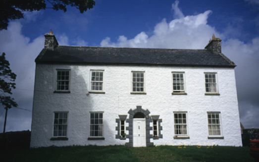 Hollywell HouseFarm house · 4.8 mi
Explorer Tom Hollywell House in Maryville, County Clare, had its top floor chopped off around 1910 because it got too tall for its…
 Caherminnaun Castle (in ruins)Castle, unclassified · 4.9 mi
Explorer Tom Caherminnaun Castle is basically a heap of rubbish that thinks it's a monument. O’Curry said it was 'a heap of ruins'…
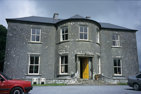 Ballykeel HouseCountry house · 5.0 mi
Explorer Tom Ballykeel House in Ballykeel South is a c. 1800 country house with a bowed central section that looks like it’s trying…
 Burren Centre KilfenoraVisitor information · 5.3 mi
Explorer Tom The Burren Centre in Kilfenora is a sensible first stop before trying to make sense of north Clare's limestone hills. I…
 Kilfenora GAA pitchGAA ground · 5.5 mi
 Graveyard in KilcarraghGraveyard · 5.5 mi
Explorer Tom Graveyard in Kilcarragh only has one stone, so if you drop your phone there, that’s officially it for the whole place.…
More archaeology and monuments in County Clare · All of County Clare

What do you know about this place?Tap to add a comment or ask a question