DDiscover AloneMapAbout

Gragan Castle

Castle, tower house
Gragan Castle
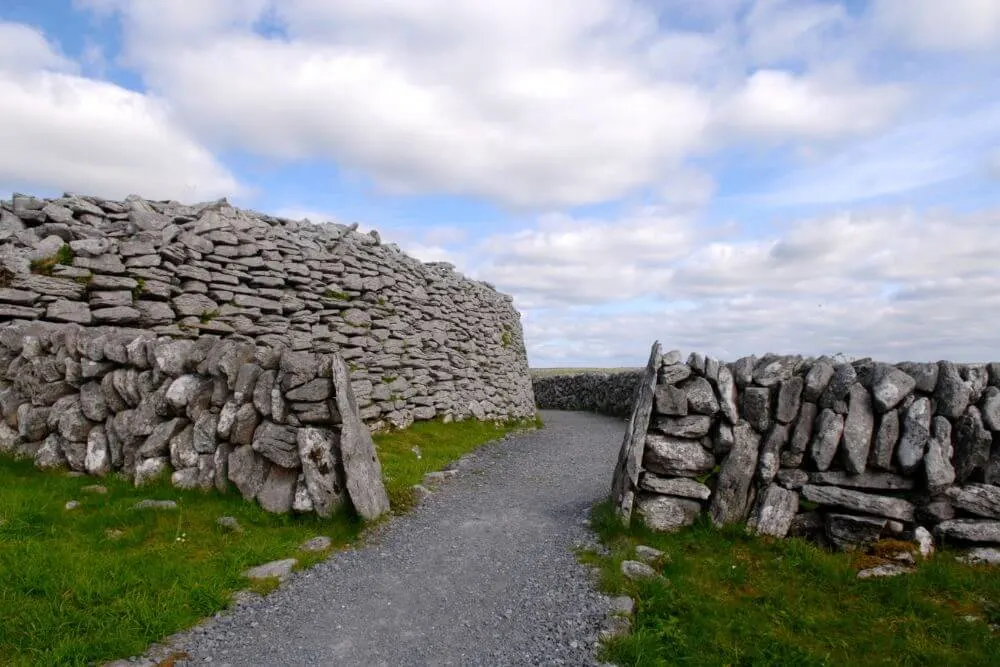
Representative picture, exact place not confirmed
Photo: Maker not stated on source page, tr.pinterest.com · Report the wrong picture

The monument record does not grant public access. Check the route and ask the landowner before entering private land.

What do you know about this place?Tap to add a comment or ask a question

What you write will be public.

What is recorded here

In woodland near the N foot of Corkscrew Hill. Renovated and reoccupied in the late-1990s. Indicated and named ‘Gragan Castle (in ruins)’ on both the first edition (1842) and later, Cassini edition (1916) of the OS 6-inch map. According to O’Donovan (Comber 1997, 74), it was the chief residence of ‘O’Loughlin, Chief…

Read the whole record
In woodland near the N foot of Corkscrew Hill. Renovated and reoccupied in the late-1990s. Indicated and named ‘Gragan Castle (in ruins)’ on both the first edition (1842) and later, Cassini edition (1916) of the OS 6-inch map. According to O’Donovan (Comber 1997, 74), it was the chief residence of ‘O’Loughlin, Chief of Burren, in the reign of Queen Elizabeth and from it the Territory of the Burren was called the Barony of Gragans’. Ua Cróinín and Breen (2014, and see attached document) state that the O’Loughlins were often at odds with the English and in one of several pardons granted to them in the late 16th century, the land and castle is recorded as being regranted to them. In 1632-33, following rebellion, it was part of Owen More O’Loughlin’s property and disposed of to George Martyn, Mayor of Galway, but it was retained within the O’Loughlin family through marriage between Turlough O’Loughlin and Martyn’s daughter Alice. Their son George took the name Martyn and his descendants continued to live nearby until recently; the castle fell into ruin before 1837 and reconstruction commenced in the mid-1990s (ibid.). A rectangular (10m N-S; 7m E-W) three-story tower house incorporating the NW wall of an enclosing bawn (CL005-088003-), with the remains of a later, 16th/17th century house adjacent to NE, also on the bawn’s NW wall line. The towerhouse is built of uncoursed, limestone rubble masonry with a base batter and traces of surviving external render. There is a buttress against the S wall. The structure is dated on stylistic grounds (finely cut quoins and architectural features) by Ua Cróinín and Breen (ibid.) to the first half of the 16th century. Ground floor access is through a pointed-arched doorway towards the N-end of the E wall which is defended by a machicoulis above. Immediately inside to right (N) is a small porter’s chamber and opposite it (to S) an intramural stairs. The main ground floor beyond comprises two parallel, vaulted-ceiling chambers (each c. 3.4m N-S; 3.3m E-W). The N chamber contains traces of a fireplace in the W wall and a door in its S wall leads to a second, S chamber. This room is lit by a loop set in double-splayed embrasure in the W wall and a pointed arched doorway in the S wall opens into a very small (1.7m E-W; 1.3m N-S) secure chamber with a corbelled ceiling: an external bolt-hole indicates the chamber could be locked from outside. The straight intramural stairs in the E wall rises to become a spiral stairs in the SE angle which leads to first-floor level and continues on up thtough the building. The stairwell is lit by loops set in internally splaying embrasures. The first floor comprises a single chamber (9.1m N-S; 4.5m E-W) accessed off the spiral stair in the SE corner. There is a garderobe shaft opposite, in the NE corner, and the room is lit by mullioned windows in the S and E walls, one loop set in an inwardly splaying embrasure in the N wall and three more in the E wall. An aumbry and chimney flue flank a centrally placed fireplace in the W wall. Several external corbels, which would have supported a corner machicoulis, project from the SW angle. The second floor is lit by a double-mullioned window in the S wall and a narrow loop in the N wall. There is a mantled fireplace in the W wall which Ua Cróinín and Breen (ibid.) date to the 17th century. See attached document with details from Risteárd Ua Cróinín and Martin Breen, The Castles and Tower-houses of Co. Clare (unpublished report). Uploaded courtesy of R. Ua Cróinín and M. Breen.

From the National Monuments Service (Archaeological Survey of Ireland) record CL005-088001

Places near here

Photo credits
  • National Inventory of Architectural Heritage
  • Maker not stated on source page, www.gettyimages.com.au
  • Maker not stated on source page, www.dreamstime.com
  • Maker not stated on source page, en.wikipedia.org
  • Andreas F. Borchert, Wikimedia Commons · CC BY-SA 4.0
  • Maker not stated on source page, www.pinterest.com
  • Maker not stated on source page, www.letsgoireland.com
  • Maker not stated on source page, en.m.wikipedia.org
  • Maker not stated on source page, www.alamy.com
  • Oliver Dixon, Wikimedia Commons · CC BY-SA 2.0
Gregans CastleHouse · 353 yd

Explorer Tom Gregans Castle in Gragan East, County Clare, is throwing a massive fit because some bloke added a hotel wing to it in…

Cross-inscribed stone in Gragan EastCross-inscribed stone · 1007 yd

Explorer Tom Cross-inscribed stone in Gragan East is hiding in a bank of stone spoil, acting like it didn't just borrow a cross from…

Bullaun stone in Croagh NorthBullaun stone · 1237 yd

Explorer Tom Bullaun stone in Croagh North has a hollow that looks like it swallowed a spoon whole and kept it. I bet the matchmaker…

Fairy fort / stone ringfort in Faunarooska (rathborney Ed)Fairy fort / stone ringfort · 1.4 mi

Explorer Tom Fairy fort / stone ringfort in Faunarooska thinks tourists from Dublin are all wind and no substance. It’s got wide…

Wedge tomb in Faunarooska (rathborney Ed)Wedge tomb · 1.4 mi

Explorer Tom Wedge tomb in Faunarooska has a very strong opinion that the local sheep are all liars and none of them are telling the…

Cist in LislarheenmoreCist · 1.7 mi

Explorer Tom Cist in Lislarheenmore set itself a New Year's resolution to be found by someone other than the same two guys who've…
Fairy fort / stone ringfort in Ballyconnoe North,cullaun (burren By.)Fairy fort / stone ringfort · 2.1 mi

Explorer Tom Fairy fort / stone ringfort in Ballyconnoe North, Cullaun would cope on a reality show by refusing to move and letting…

Enclosure in DerrynavahaghEnclosure · 2.4 mi

Explorer Tom Enclosure in Derrynavahagh is basically an annexe to its bigger brother, which makes it feel like the spare bedroom of…

Enclosure in Ballyconnoe NorthEnclosure · 2.7 mi

Explorer Tom Enclosure in Ballyconnoe North has a secret talent for disappearing into the grass whenever the sun hits it at exactly…

Bullaun stone in Formoyle WestBullaun stone · 2.7 mi

Explorer Tom Bullaun stone in Formoyle West had a massive feud with the rain until it disappeared in 1987, which feels like a very…

Holy well in Formoyle WestHoly well · 2.8 mi

Explorer Tom Holy well in Formoyle West is invisible at ground level, which is great for keeping secrets but terrible for finding it…

Noughaval Church (in ruins)Church · 4.3 mi

Explorer Tom Noughaval Church is being picked on by the wind because it stands right on the edge of a slope, which means it gets…

More castles and forts in County Clare · All of County Clare

Add to this placeAdd a picture Add a detailed tip Add a story

Explore the map1,095,414 places to discover

Next place · or swipeGregans Castle