
What is recorded here
In pasture, on top and around the sides of a natural hillock 350m NW of the Camoge River and the townland boundary with Cahercorney, with excellent views in all directions. The cashel on the summit of Knockcorragh (LI023-088----) is located within the field system. The field system is partially depicted on the OSi…
Read the whole record
From the National Monuments Service (Archaeological Survey of Ireland) record LI023-273
Places near here
Photo credits
- Maker not stated on source page, www.pinterest.com
- National Inventory of Architectural Heritage
- Maker not stated on source page, www.gettyimages.com
- Maker not stated on source page, evoke.ie
- Maker not stated on source page, ca.pinterest.com
- Maker not stated on source page, ru.pinterest.com
- Kmcnamee, Wikimedia Commons · CC BY-SA 4.0
- No machine-readable author provided. Christian1965~commonswiki assumed (based on copyright claims)., Wikimedia Commons · Public domain
- Knockane GAA Club website; individual photographer not stated, www.knockane.com
 Fairy fort / stone ringfort in KnockcorraghFairy fort / stone ringfort · 37 yd
Explorer Tom Fairy fort / stone ringfort in Knockcorragh has a family tree that’s mostly made up of stones and rock outcrops…
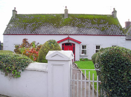 Caherelly CottageHouse · 602 yd
Explorer Tom Caherelly Cottage in Knockcorragh witnessed a love story that went badly wrong right next door, spilling the drama onto…
 Fairy fort / earthen ringfort in Caherelly WestFairy fort / earthen ringfort · 693 yd
Explorer Tom Fairy fort / earthen ringfort in Caherelly West claims it’s older than the concept of time itself. I believe it’s…
 Fairy fort / earthen ringfort in BallysallaghFairy fort / earthen ringfort · 732 yd
Explorer Tom Fairy fort / earthen ringfort in Ballysallagh sits on a hillock with concrete farm buildings staring at it like nosy…
 Black Castle (site of)Archaeological place · 957 yd
Explorer Tom Black Castle was built on a bargain where the builder promised the devil he’d never wear socks again for a hundred…
 Caherelly CastleCountry house · 958 yd
Explorer Tom Caherelly Castle in Caherelly West is secretly a cottage that bought a fake mustache and a plaque. It would tell its…
 Castle (in ruins)Castle, tower house · 974 yd
Explorer Tom Castle in Caherelly West held a dance that went on until the roof caved in slightly. It’s still standing, but it’s…
 Ballybricken/Bohermore GAA pitchGAA ground · 1200 ydFairy fort / earthen ringfort in Caherelly EastFairy fort / earthen ringfort · 1423 yd
Explorer Tom Fairy fort / earthen ringfort in Caherelly East is hiding a secret tunnel straight to the village pub. I bet the…
Fairy fort / earthen ringfort in CahercorneyFairy fort / earthen ringfort · 1531 ydExplorer Tom Fairy fort in Cahercorney would tell its younger self to stop worrying about the entrance because no one can find it…
 Áine and Gearóid Iarla: Lough GurLegend location · 1.7 mi
Explorer Tom Áine and Gearóid Iarla: Lough Gur has a goddess for the lake and a sleeping lord in the old stories. I thought I was…
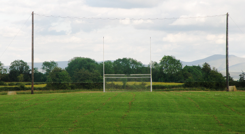 Knockainey GAA pitchGAA ground · 4.6 mi
More archaeology and monuments in County Limerick · All of County Limerick

What do you know about this place?Tap to add a comment or ask a question