
What is recorded here
From the National Monuments Service (Archaeological Survey of Ireland) record ME039-022
Places near here
Photo credits
- Maker not stated on source page, fi.pinterest.com
- C O'Flanagan, Geograph · CC BY-SA 2.0
- Maker not stated on source page, ms.fusedlearning.com
- Maker not stated on source page, tr.pinterest.com
- PST Sport (individual photographer not stated), pstsport.com
- National Inventory of Architectural Heritage
- Maker not stated on source page, www.dreamstime.com
- Maker not stated on source page, en.wikipedia.org
- Maker not stated on source page, uk.pinterest.com
 St. Declan's CemeteryCemetery · 918 yd
Explorer Tom St. Declan's Cemetery in County Meath smells like old wet wool and forgotten secrets, according to my very sensitive…
 Church (in Ruins)Church · 1425 yd
Explorer Tom Church in Crickstown's New Year's resolution was to stop being so difficult about its own location. It wasn't even…
 Fairy fort / earthen ringfort in KilleglandFairy fort / earthen ringfort · 1.1 mi
Explorer Tom Fairy fort / earthen ringfort in Killegland wants to tell the N2 bypass: 'You could have just knocked first.' It’s a…
 Fairy fort / ringfort in BallymadunFairy fort / ringfort · 1.1 mi
Explorer Tom Fairy fort / ringfort in Ballymadun. Local tradition says this bank leads from Tara to the sea. That’s quite a long…
 Donaghmore/Ashbourne GAA pitchGAA ground · 1.2 mi
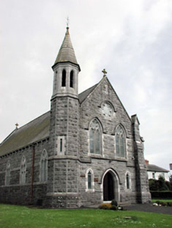 Saint Andrew's Catholic ChurchChurch/chapel · 1.2 mi
Explorer Tom Saint Andrew's Church has an octagonal belfry that’s doing its best to stand out from the crowd in Crickstown. The…
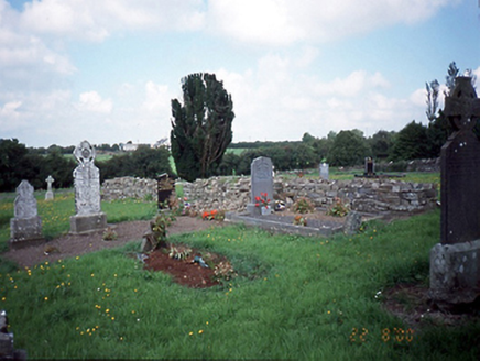 graveyard/cemetery1.3 mi
Explorer Tom Graveyard or cemetery in Glebe Garristown Ed has rules for visitors that basically say 'don't touch the 1600s stones…
 Killegland CastleCastle, tower house · 1.3 mi
Explorer Tom Killegland Castle is stuck in a feud with the river over who owns the view, and honestly, the river has more character…
 Enclosure in KnavinstownEnclosure · 1.4 mi
Explorer Tom Enclosure in Knavinstown would win a county fair prize for 'Most Boring Circle' and absolutely deserve it. It sits…
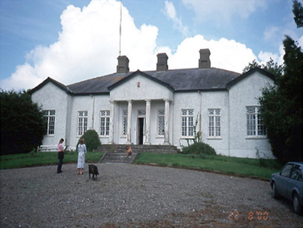 Laurel MountCountry house · 1.8 mi
Explorer Tom Laurel Mount is secretly proud of one specific potato it grew in 1800, and it hasn’t stopped bragging about it since.…
EnclosureEnclosure, large enclosure · 2.2 miExplorer Tom Enclosure at Kilbrew is huge and has no entrance, which is rude for a house party. Locals swear if you trip, a ghost is…
 Piercetown GraveyardGraveyard · 4.2 mi
Explorer Tom Piercetown Graveyard in County Meath once hosted the most dramatic argument over a fence post I’ve ever heard of. Two…
More archaeology and monuments in County Meath · All of County Meath

What do you know about this place?Tap to add a comment or ask a question