
Places near here
Photo credits
- National Inventory of Architectural Heritage
- Willow, Wikimedia Commons · CC BY 2.5
- C O'Flanagan, Geograph · CC BY-SA 2.0
- J. Stirling Coyne, Wikimedia Commons · Public domain
- Thomas Nugent, Geograph · CC BY-SA 2.0
- C O'Flanagan, Geograph · Creative Commons Attribution-ShareAlike 2.0
- N Chadwick, Wikimedia Commons · CC BY-SA 2.0
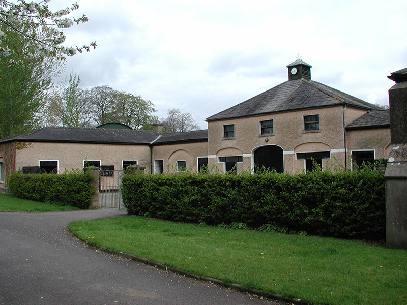 Galtrim HouseStables · 1.5 mi
Explorer Tom Galtrim House in Galtrim used to house horses that probably thought they were royalty themselves. The blind arches look like they’re judging your life choices right now. Have a nosey, politely from the pavement if possible.
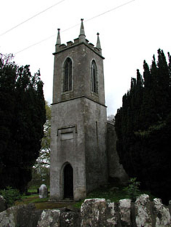 Saint Mary's Church (Galtrim)Church/chapel · 1.5 mi
Explorer Tom Saint Mary's Church in Galtrim is pretending to be ancient, but a local swears he invented it last Tuesday. The limestone pinnacles are lovely, though, even if they look like frozen broccoli. A perfect detour while you stretch your legs.
Railway Woods (North)Forest · 2.5 miExplorer Tom Railway Woods (North) in County Meath got its name wrong because the map makers were too busy arguing about which way is north. They ended up labeling everything twice and never went back to fix it, so now it’s just ‘North’ by default. Spot the oldest stone and give it a name.
 European ash3.0 mi
Explorer Tom European ash in County Meath is the rabbits’ favourite playground, and they think it owes them rent for living there. It’s got a vibe that says “don’t touch me” but invites you to anyway. Take a breath of that air, it's older than your car.
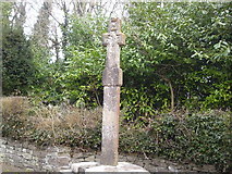 Dunsany CrossCross, Wayside cross · 3.3 mi
Explorer Tom Dunsany Cross is like the awkward uncle at a wedding, standing right by the castle entrance and pretending it doesn’t know anyone. It’s made of granite but people used to think it was limestone, which is a classic case of mistaken identity for a two-meter stone. It’s just there on the road, looking rectangular and unimpressed by your outfit. Have a look and decide if I was lying.
 Dangan CastleCastle, tower house · 3.4 mi
Explorer Tom Dangan Castle thinks Dublin tourists are all wind and no substance because they never stay long enough to appreciate the quiet. It’s been passed down through families so many times it probably has three different surnames in its head. Tell it a joke, it's been a long time since anyone did.
MullaghMountain / peak · 3.5 miExplorer Tom Mullagh is sitting there looking so unimpressed that I think it might be judging your footwear choices from up high. A cow once tried to buy it with a very confident moo, but Mullagh didn't even blink. It’s just a hill that thinks it’s a fortress, which is a bit of a stretch. Bring your nan, she'll know more than me.
 Killeen CastleCastle, tower house · 3.8 mi
Explorer Tom Killeen Castle has a curse that only affects people who don't wave when they pass by, so make sure you give it a big thumbs-up from the car window. It’s a tower house sitting on a slight slope, looking like it’s about to tip over into the next county if the wind picks up. The Cussack family probably didn't know what they had until it started growing moss. Find the wonkiest bit and send it
 IndicatedGraveyard · 3.9 mi
Explorer Tom Graveyard in Kilmessan would tell the new church to stop hogging the spotlight and share the headstones. The medieval bits are gone but the attitude remains. Bring a map, get lost anyway, that's the fun.
1798 MemorialMemorial · 4.2 miExplorer Tom The 1798 Memorial in County Meath would be the uncle at a wedding who stands slightly too close and gives unsolicited advice about history. It’s got that intense focus on the past while completely ignoring what is happening right now around it. You can’t help but notice its presence even if you don't want to. Ring your granny and tell her where you are.
Larchil Arcadian GardensHeritage attraction · 4.3 miExplorer Tom Larchill is what happens when a farm decides ordinary fields are too sensible. Robert Prentice began turning the Meath estate into an ornamental landscape after leasing it in 1708. Later owners added follies and other carefully arranged surprises. By 1994 the lake had been drained, the walled garden was used for grazing and several follies were in poor shape; new owners set about restoring them. I would build one decorative tower and spend the rest of my life explaining why it was necessary. The grounds are privately managed, so check current opening, booking and permitted paths before visiting. Wander from feature to feature without assuming every odd building had a practical job. Here, making a visitor grin was sometimes the job.
 Trim Castle KeepVisitor attraction · 6.1 mi
Explorer Tom Trim Castle Keep in County Meath would spend its lotto win on a massive air conditioning unit because it’s freezing inside despite being a castle. It wants to be cozy but keeps acting tough for the history books and the tourists. Bring a map, get lost anyway, that's the fun of navigating its maze.
More archaeology and monuments in County Meath · All of County Meath

What do you know about this place?Tap to add a comment or ask a question