
What is recorded here
From the National Monuments Service (Archaeological Survey of Ireland) record ME019-091
Places near here
Photo credits
- Maker not stated on source page, ch.pinterest.com
- Maker not stated on source page, www.pinterest.com
- Maker not stated on source page, commons.wikimedia.org
- Maker not stated on source page, irisharchaeology.org
- National Inventory of Architectural Heritage
- Maker not stated on source page, www.pinterest.ca
 Passage tomb in KnowthPassage tomb · 1127 yd
Explorer Tom Passage tomb in Knowth would teach history by pointing at itself and saying 'look how close I am to the river', which…
 Ceremonial stone setting in KnowthCeremonial stone setting · 1242 yd
Explorer Tom Ceremonial stone setting in Knowth makes a spooky clunking sound at midnight, probably from its own insecurity. It’s…
 Passage tomb art in KnowthPassage tomb art · 1359 yd
Explorer Tom Passage tomb art in Knowth would complain to the council that its spiral has been sitting in a shed since 2011 looking…
 Linear earthwork in SlaneLinear earthwork · 1372 yd
Explorer Tom Linear earthwork in Slane made a New Year's resolution to finally move two inches west, but it has been procrastinating…
 Fairy fort / earthen ringfort in Fennor (duleek Lower By.)Fairy fort / earthen ringfort · 1708 yd
Explorer Tom Fairy fort / earthen ringfort in Fennor hides under the River Boyne like a shy secret. A poet fell in the ditch nearby…
 Littlewood ForestVisitor information · 1.4 mi
Explorer Tom Littlewood Forest in County Meath is probably posting updates on social media about how majestic it is, complete with…
 Rock HouseGates/railings/walls · 1.5 mi
Explorer Tom Rock House gates in Slane are part of an eighteenth-century estate village where Viscount Conyngham told everyone what…
 Regina HouseOutbuilding · 1.5 mi
Explorer Tom The other Regina House in Slane has a long-standing grudge with the local weather system. It stands there looking smug…
 canal (section of)1.5 mi
Explorer Tom Canal in Slanecastle Demesne cost seventy-five thousand pounds to dig, which is basically a fortune for water. It’s…
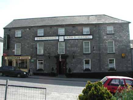 Conyngham Arms HotelHouse · 1.5 mi
Explorer Tom Conyngham Arms Hotel in Slane would post a photo of itself with the caption 'Main Street royalty'. It’s got that big…
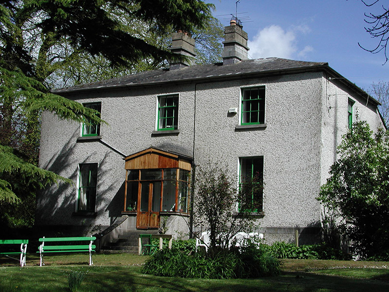 KillrianRectory/glebe/vicarage/curate's house · 1.5 mi
Explorer Tom Killrian rectory is where a priest once lost a bet to a vicar about who could eat more pies. The lamp standard came…
 Saint Patrick's Church GraveyardGraveyard · 1.6 mi
Explorer Tom Saint Patrick's Church Graveyard in County Meath is still seething because that one bishop refused to visit back in the…
More archaeology and monuments in County Meath · All of County Meath

What do you know about this place?Tap to add a comment or ask a question