
What is recorded here
On a N-facing slope in gently undulating terrain overlooking the River Suir, in pasture. Possibly associated with Castlelake tower house (TS060-116001-) c. 150m to the NE and settlement (TS060-116----). Ballynahinch tower house (TS060-059001-) is across the river c. 400m to the NW. A large sub-rectangular enclosure (diam. 85m N-S; 30.7m E-W) defined by an earthen and stone bank (Wth 1.8m crest; 3.5-5.2m base; int. H 0.2m; ext. H 0.17-0.5m). The S end has been truncated by a farm roadway running E-W along the N side of the field boundary which runs E-W at the S end of the enclosure. The enclosure tapers towards the S to 24m E-W. Currently the enclosure N of the roadway is divided into two paddocks. Further earthen banks are evident in the field S of the farm roadway extending S from the enclosure, though not forming any clear pattern. At least two banks are clearly aligned N-S, falling with the natural slope, one of which may be an earlier field boundary as it appears in roughly the same location as a line of trees on the 1st (1840) ed. OS 6-inch map.
See attached:
TS060-116004- OS Ortho, viewed 8 March 2021
Compiled by: Jean Farrelly
Date of upload: 15 July 2014
The monument record does not grant public access. Check the route and ask the landowner before entering private land.
- What survives
- Recorded monument
Places near here
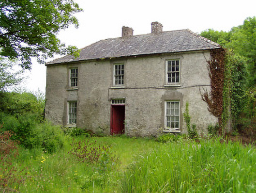 Castlelake Millmiller's house · 385 yd
 IndicatedBuilding · 433 yd
 Ballynahinch Castle (in ruins)Castle, tower house · 456 yd
 Settlement cluster in Ballynahinch (ballygriffin Par.)Settlement cluster · 642 yd
 Enclosure in Ballinamona (horeabbey Par.)Enclosure · 925 yd
 Site of CastleCastle, unclassified · 1.5 mi
 Hore AbbeyHeritage attraction · 2.0 mi
 Athassel PrioryHeritage attraction · 3.0 mi
 Dundrum Woods (Marl Bog)Forest · 5.5 mi
 Maudemount BogWood · 6.2 mi
 I.R.A. 3rd. Tipperary Brigade MemorialMemorial · 8.8 mi
 Soloheadbeg Ambushambush · 9.0 mi
Other information
Photo: Credit not shown in the picture search · Rights wording not checked; contact us if this picture should be removed