
What is recorded here
From the National Monuments Service (Archaeological Survey of Ireland) record KE013-004
Places near here
Photo credits
- Maker not stated on source page, www.dreamstime.com
- Maker not stated on source page, en.wikipedia.org
- Maker not stated on source page, www.summitpost.org
- Maker not stated on source page, www.flickr.com
- Colin Park, Geograph · CC BY-SA 2.0
- Neville Goodman, Geograph · Creative Commons Attribution-ShareAlike 2.0
- National Inventory of Architectural Heritage
 Standing stone in TiduffStanding stone · 377 yd
Explorer Tom This irregular stone sits next to its friend, waiting for a prophecy about world peace that never came true. It’s only…
 Linear earthwork in TiduffLinear earthwork · 587 yd
Explorer Tom Linear earthwork in Tiduff has a family tree made entirely of tall tales and red dirt. It’s basically a long line that…
 Megalithic structure in TiduffMegalithic structure · 1275 yd
Explorer Tom Megalithic structure in Tiduff is judging your modern architecture from a distance, unimpressed by all that glass and…
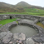 Fairy fort / stone ringfort in TiduffFairy fort / stone ringfort · 1.2 mi
Explorer Tom Fairy fort / stone ringfort in Tiduff has two underground holes that look like giant rabbit burrows. The seagulls claim…
 Fairy fort / stone ringfort in GlenderryFairy fort / stone ringfort · 1.7 mi
Explorer Tom Fairy fort / stone ringfort in Glenderry smuggled illegal cheese in 1750 and got away with it. It’s called ‘Fort of the…
 Triskbeg MountainMountain / peak · 2.0 mi
Explorer Tom Triskbeg Mountain has a hidden message carved into its stones that only appears when you squint really hard through…
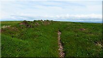 Maulin MountainMountain / peak · 2.4 mi
Explorer Tom Maolán Buí in County Kerry is stuck in a feud over who owns the best view for sunset. The families argue so much…
 Church in BooleenshareChurch · 4.7 mi
Explorer Tom Booleenshare Church has a tunnel leading straight to the pub if you believe the old stories. The lads say the ale is…
 Graveyard in BooleenshareGraveyard · 4.7 mi
Explorer Tom Graveyard in Booleenshare would cope brilliantly on a reality show by just lying down and doing nothing. It's mostly…
 Our Lady's Holy WellSpring · 4.9 mi
Explorer Tom Our Lady’s Holy Well thinks tourists from Dublin smell like overpriced coffee and bad decisions, yet she keeps…
 Old Graveyard BallyheigueGraveyard · 4.9 mi
Explorer Tom Old Graveyard Ballyheigue has changed so many names that even the ghosts are confused about who they're buried with.…
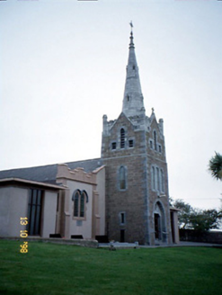 Saint Mary's Catholic ChurchChurch/chapel · 4.9 mi
Explorer Tom Saint Mary's Catholic Church in Booleenshare was built where a poet fell into a ditch and wrote a sonnet. The tower…
More archaeology and monuments in County Kerry · All of County Kerry

What do you know about this place?Tap to add a comment or ask a question