
What is recorded here
The Red Ditch. The possible starting point of this earthwork is situated N of Cahercarbery (More) promontory fort (KE013-001----). It is marked on the 1840-41 and 1916 OS maps as 'Track of Red Ditch'. It is better known as the 'Claí Rua', phonetically called 'Cleeroo'. Many accounts have been written on the Claí Rua,…
Read the whole record
From the National Monuments Service (Archaeological Survey of Ireland) record KE013-003
Places near here
Photo credits
- Maker not stated on source page, www.summitpost.org
- Maker not stated on source page, www.flickr.com
- Maker not stated on source page, www.dreamstime.com
- Colin Park, Geograph · CC BY-SA 2.0
- Maker not stated on source page, en.wikipedia.org
- Neville Goodman, Geograph · Creative Commons Attribution-ShareAlike 2.0
- National Inventory of Architectural Heritage
 Megalithic structure in TiduffMegalithic structure · 814 yd
Explorer Tom Megalithic structure in Tiduff is judging your modern architecture from a distance, unimpressed by all that glass and…
 Fairy fort / stone ringfort in TiduffFairy fort / stone ringfort · 1626 yd
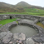
Explorer Tom Fairy fort / stone ringfort in Tiduff has two underground holes that look like giant rabbit burrows. The seagulls claim…
 Cross-inscribed stone in GlenderryCross-inscribed stone · 1.6 mi
Explorer Tom Rock art in Glenderry is having a rivalry with a much more famous cross just down the road because it has red paint on…
 Fairy fort / stone ringfort in GlenderryFairy fort / stone ringfort · 1.6 mi
Explorer Tom Fairy fort / stone ringfort in Glenderry smuggled illegal cheese in 1750 and got away with it. It’s called ‘Fort of the…
Fairy fort / earthen ringfort in GlenderryFairy fort / earthen ringfort · 1.7 miExplorer Tom Fairy fort / earthen ringfort in Glenderry would have a tombstone saying 'Sorry I wasn't found'. It vanished after…
 Triskbeg MountainMountain / peak · 2.0 mi
Explorer Tom Triskbeg Mountain has a hidden message carved into its stones that only appears when you squint really hard through…
 Maulin MountainMountain / peak · 2.5 mi
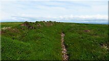
Explorer Tom Maolán Buí in County Kerry is stuck in a feud over who owns the best view for sunset. The families argue so much…
 Church in BooleenshareChurch · 4.8 mi
Explorer Tom Booleenshare Church has a tunnel leading straight to the pub if you believe the old stories. The lads say the ale is…
 Graveyard in BooleenshareGraveyard · 4.8 mi
Explorer Tom Graveyard in Booleenshare would cope brilliantly on a reality show by just lying down and doing nothing. It's mostly…
 Our Lady's Holy WellSpring · 4.9 mi
Explorer Tom Our Lady’s Holy Well thinks tourists from Dublin smell like overpriced coffee and bad decisions, yet she keeps…
 Old Graveyard BallyheigueGraveyard · 4.9 mi
Explorer Tom Old Graveyard Ballyheigue has changed so many names that even the ghosts are confused about who they're buried with.…
 Saint Mary's Catholic ChurchChurch/chapel · 5.0 mi
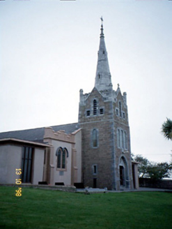
Explorer Tom Saint Mary's Catholic Church in Booleenshare was built where a poet fell into a ditch and wrote a sonnet. The tower…
More archaeology and monuments in County Kerry · All of County Kerry

What do you know about this place?Tap to add a comment or ask a question