What is recorded here
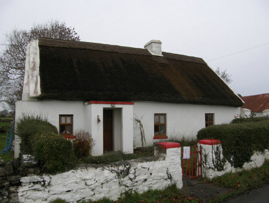
Farm house in Kinlough has an open porch built to stop the wind, a little waiting room for weather with no intention of waiting. A Mayo draught would be through the door and criticising the fire before you’d offered it a chair.
Detached four-bay single-storey direct entry thatched farmhouse with dormer attic, extant 1838[?], with single-bay single-storey flat-roofed open windbreak. Renovated. Pitched roof with part chicken wire-covered replacement reed or rye straw thatch, rope twist above exposed hazel lattice stretchers to raised ridge having exposed scallops, rendered dwarf chimney stack having chamfered capping, and concrete or rendered coping to gables. Replacement cement rendered battered walls; limewashed surface finish to side (north-east) elevation. Square-headed window openings with concrete sills, and concealed dressings framing replacement uPVC casement windows replacing one-over-one timber sash windows. Square-headed opposing door openings with concealed dressings framing replacement uPVC panelled half-doors. Set back from line of road on a corner site with limewashed piers to perimeter supporting barley twist-detailed looped flat iron gate.
A farmhouse identified as an integral component of the vernacular heritage of south County Mayo by such attributes as the rectilinear direct entry plan form; the construction in unrefined local fieldstone displaying a battered silhouette; and the high pitched roof showing a replenished thatch finish. However, while the elementary form and massing survive intact, the introduction of replacement fittings to the openings has not had a beneficial impact on the character or integrity of the composition. Nevertheless, adjacent limewashed outbuildings (extant 1924) continue to contribute positively to the group and setting values of a neat self-contained ensemble making a pleasing visual statement in a pastoral street scene.
From the Buildings of Ireland (National Inventory of Architectural Heritage) record 31312218
This does not grant access. Most recorded buildings are privately owned; view them only from public ground unless the owner allows entry.
Places near here
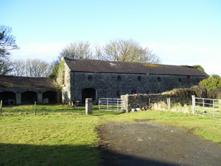 Moyne HillOutbuilding · 754 yd
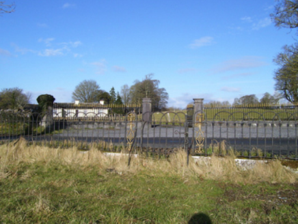 Moyne HillDemesne walls/gates/railings · 880 yd
 Kinlough CastleCastle · 1065 yd
_-_geograph.org.uk_-_5829239.jpg/250px-Castles_of_Connacht,_Moyne,_Mayo_-_revisited_(1)_-_geograph.org.uk_-_5829239.jpg "Photo: Mike Searle, Wikimedia Commons · CC BY-SA 2.0") Moyne Castle in ruinsCastle, unclassified · 1500 yd
Moyne Castle in ruinsCastle, unclassified · 1500 yd Ross Errilly FriaryHeritage attraction · 1.6 mi
 Shrule AbbeyArchaeological place · 1.7 mi
 Grave YardGraveyard · 2.2 miCregg PlantationForest · 2.8 miPesooge PlantationForest · 3.0 mi
 Kilcoona Round TowerHeritage attraction · 4.6 miRabbit IslandIslet · 6.0 miFreeheen IslandIslet · 6.1 mi
Pictures: National Inventory of Architectural Heritage; Mike Searle, Wikimedia Commons · CC BY-SA 2.0; The original uploader was Dppowell at English Wikipedia ., Wikimedia Commons · CC BY-SA 2.5; Bmcgeene, Wikimedia Commons · CC BY-SA 4.0; Nigel Thompson, Geograph · Creative Commons Attribution-ShareAlike 2.0; Wanfried-Dublin, Wikimedia Commons · CC BY-SA 3.0
More historic places in County Mayo · All of County Mayo
What do you know about this place?