What is recorded here
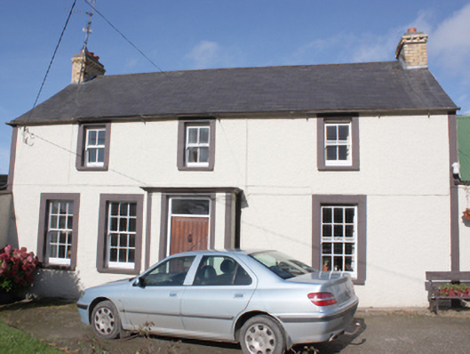
Detached three-bay two-storey farm house, built c. 1890, with projecting porch to front elevation, and modern extension to rear. Pitched slate roof with grey clayware ridge tiles, yellow brick on stretcher bond chimneystacks to gables with cogging stringcourse, rendered coping, and terracotta pots, and cast-iron…
Read the whole record
From the Buildings of Ireland (National Inventory of Architectural Heritage) record 40902115
Places near here
Photo credits
- National Inventory of Architectural Heritage
- Maker not stated on source page, www.pinterest.com
- P L Chadwick, Geograph · CC BY-SA 2.0
- Kenneth Allen, Geograph · CC BY-SA 2.0
- Oliver Dixon, Wikimedia Commons · CC BY-SA 2.0
- Andreas F. Borchert, Wikimedia Commons · CC BY-SA 4.0
- Richard Webb / Geograph Ireland, www.geograph.ie
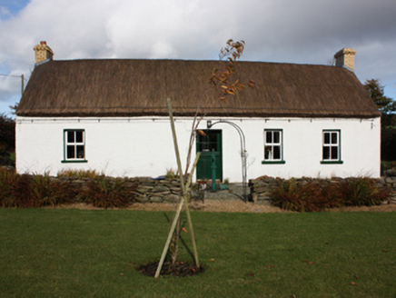 The ThatchHouse · 66 yd
Explorer Tom The Thatch wears its rounded pitched thatched roof like a helmet tuned for the Inishowen wind. I picture it smoothing…
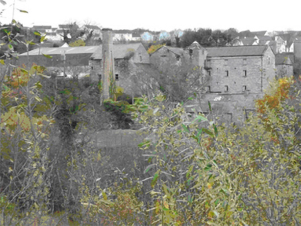 Gulladoo MillMill (water) · 957 yd
Explorer Tom Gulladoo Mill in Goladoo would spend its lotto winnings on a really big umbrella and a very loud pair of earplugs for…
 bridge971 yd
Explorer Tom Bridge in Ballynally has one round arch and square stone buttresses on the way into Moville. The survey suggests a date…
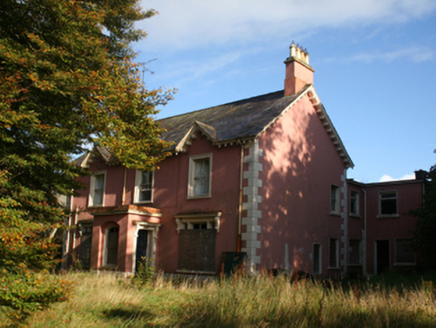 RosebankHouse · 997 yd
Explorer Tom Rosebank has two gabled roof projections that look like a very confused, double-hatted giant. I picture them tilting…
 Bridge in GlencrowBridge · 1074 yd
Explorer Tom Bridge in Glencrow no longer has the River Bredagh passing beneath it; the old survey found its grass-grown slabs…
 Bredagh Glen Fairy Fort / LisarveFairy fort / ringfort · 1138 yd
Explorer Tom Bredagh Glen's Lisarve is barely a trace of a circle in the old survey, perched between a stream and the Bredagh River.…
 manse1308 yd
Explorer Tom Manse in Glencrow was built around 1910. Its porch floor was recorded with coloured tiles in a geometric pattern. The…
 Rosato’sPub · 1327 yd
Explorer Tom Rosato’s is on Malin Road, which sounds like a road specifically designed for people who are completely lost. Tell them…
 Susie’s BarPub · 1362 yd
Explorer Tom Susie’s Bar in Moville is the ultimate gossip hub where Susie definitely knows who stole your socks. If she were…
 Bath GreenPark · 1506 yd
Explorer Tom Bath Green spreads beside Lough Foyle in Moville, with a shore walk that makes this little Donegal town feel much wider…
 Cooly Broken Cross SlabCross · 1709 yd
Explorer Tom Here we have the Cooly Broken Cross Slab, a modest stone tucked along the south wall of the graveyard. It’s said to…
 Carrick Field, Moville GAAGAA ground · 1730 yd
More historic places in County Donegal · All of County Donegal

What do you know about this place?Tap to add a comment or ask a question